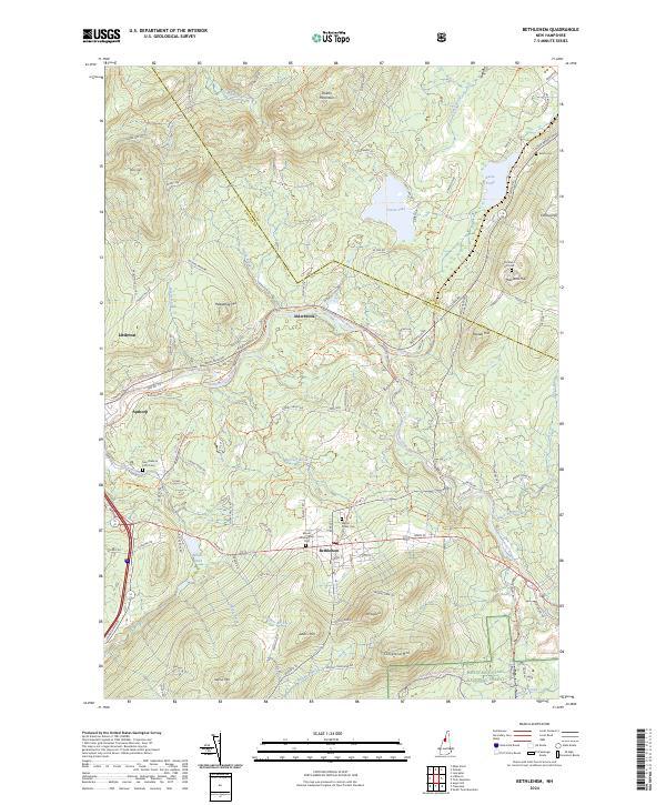
2024 Map of Bethlehem
USGS Topo · Published 2024About this map
Bethlehem sits at the heart of this landscape, where the Ammonoosuc River carves a path through the high country of the White Mountain National Forest. The map documents a town defined by its elevation and seasonal recreation, with peaks like Mt Agassiz and Cleveland Mtn overlooking the valley floor. To the north, the smaller settlements of Alderbrook and Apthorp follow the river and the old rail corridors, now represented by routes like the P & O Recreational Rail Trl. For genealogists, the map is remarkably dense with burial sites, including the Mount Washington Cem, Maple Street Cem, and the more secluded Burns Cem near Burns Pond. The northern reaches are dominated by Forest Lake and the slopes of Dalton Mountain, illustrating the transition from local commerce to the protected wilderness that has long drawn visitors to this corner of New Hampshire.
Find a feature on this map
107 named features on this map. Tap any name to fly to it.
Don’t see what you’re looking for? This feature index may not catch every label — zoom into the map to look around manually.
Map Details
Editions of this 2024 Bethlehem Map
This is the sole edition of this map. No revisions or reprints were ever made.
Other maps of this area

1900 · Whitefield
USGS Topo · 1:62,500

1929 · Moosilauke
USGS Topo · 1:62,500

1929 · Franconia
USGS Topo · 1:62,500

1931 · Littleton
USGS Topo · 1:62,500

1932 · Franconia
USGS Topo · 1:62,500

1932 · Littleton
USGS Topo · 1:48,000

1932 · Moosilauke
USGS Topo · 1:62,500

1935 · Littleton
USGS Topo · 1:62,500

1935 · Whitefield
USGS Topo · 1:48,000

1938 · Whitefield
USGS Topo · 1:62,500