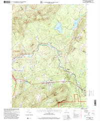
1995 Map of Bethlehem
USGS Topo · Published 2000About this map
The Ammonoosuc River carves a central path through this landscape, flanked by the high peaks of Dalton Mountain to the north and Mount Agassiz to the south. In the mid-1990s, the town of Bethlehem remains the primary hub of the region, surrounded by smaller historic settlements like Alderbrook, Maplewood, and Pierce Bridge. The transition from industrial past to recreational present is visible in the mix of land use, where the Boston and Maine railroad line shares space with the Forest Lake State Park and local golf courses.
Find a feature on this map
60 named features on this map. Tap any name to fly to it.
Don’t see what you’re looking for? This feature index may not catch every label — zoom into the map to look around manually.
Map Details
Editions of this 1995 Bethlehem Map
This is the sole edition of this map. No revisions or reprints were ever made.
Other maps of this area

1900 · Whitefield
USGS Topo · 1:62,500

1929 · Moosilauke
USGS Topo · 1:62,500

1929 · Franconia
USGS Topo · 1:62,500

1931 · Littleton
USGS Topo · 1:62,500

1932 · Franconia
USGS Topo · 1:62,500

1932 · Littleton
USGS Topo · 1:48,000

1932 · Moosilauke
USGS Topo · 1:62,500

1935 · Littleton
USGS Topo · 1:62,500

1935 · Whitefield
USGS Topo · 1:48,000

1938 · Whitefield
USGS Topo · 1:62,500