1944 Map of Betterton
USGS Topo · Published 1944About this map
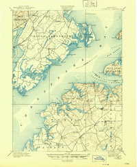
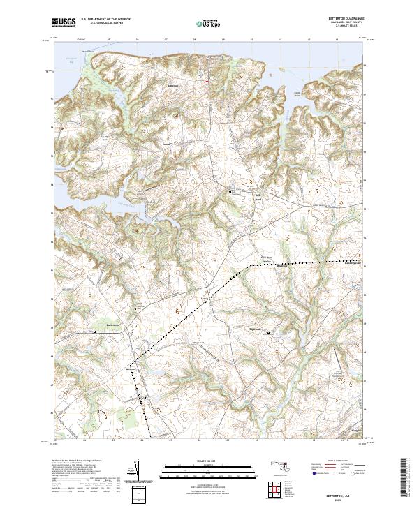
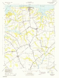
Betterton sits at the northern edge of this wartime survey, overlooking the Sassafras River and the marshes of the upper Chesapeake Bay. In 1944, this section of Kent County was defined by its agricultural character and strategic coastal position, evidenced by the presence of Camp Howell U S Army and Camp Tockwogh YMCA near Howell Pt. The landscape is etched with tidal inlets and marshes like Big Marsh and Gut Marsh, while the interior is dotted with small rural crossroads and tenant settlements. The Pennsylvania Railroad's Chestertown Branch serves as a vital corridor through the southern half of the quadrangle, connecting the shipping points at Worton and Lynch. Local community life is anchored by numerous country churches, including Mt Olive Church and Fountain Church, alongside family landmarks such as Harris Wharf on the bay side.
Find a feature on this map
42 named features on this map. Tap any name to fly to it.
Don’t see what you’re looking for? This feature index may not catch every label — zoom into the map to look around manually.
Map Details
Editions of this 1944 Betterton Map
This is the sole edition of this map. No revisions or reprints were ever made.
Historical Maps of Betterton Through Time
9 maps found