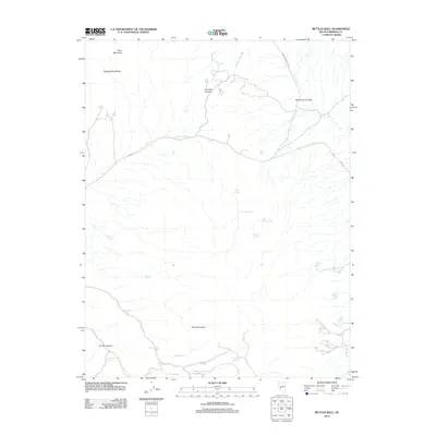
2012 Map of Bettles Well
USGS Topo · Published 2012About this map
Bettles Well and a network of scattered water sources define this arid landscape in Mineral County during the early 21st century. The terrain is structured by the Gabbs Valley Range and the Pilot Mountains, with the Monte Cristo Valley providing a low-lying corridor through the high desert. Numerous named springs, such as Wild Cat Spring, Black Jack Spring, and Warner Corral Spring, indicate the vital locations where water could be found in an otherwise parched environment. The presence of Bettles Ranch Spring and Millsite Spring suggests historical land use tied to ranching and possible industrial activities. Transportation is limited to a few rugged routes like Dump Rd and Finger Rock Wash Rd, while the towering Tim Holt Summit and Table Mountain serve as prominent landmarks for navigation across the high Nevada basins.
Find a feature on this map
26 named features on this map. Tap any name to fly to it.
Don’t see what you’re looking for? This feature index may not catch every label — zoom into the map to look around manually.
Map Details
Editions of this 2012 Bettles Well Map
This is the sole edition of this map. No revisions or reprints were ever made.
Other maps of this area

1907 · Tonopah
USGS Topo · 1:250,000

1908 · Tonopah
USGS Topo · 1:250,000

1909 · Hawthorne
USGS Topo · 1:250,000

1911 · Hawthorne
USGS Topo · 1:250,000

1915 · Hawthorne
USGS Topo · 1:250,000

1948 · Walker Lake
USGS Topo · 1:250,000

1956 · Tonopah
USGS Topo · 1:250,000

1957 · Walker Lake
USGS Topo · 1:250,000

1959 · Tonopah
USGS Topo · 1:250,000

1962 · Walker Lake
USGS Topo · 1:250,000