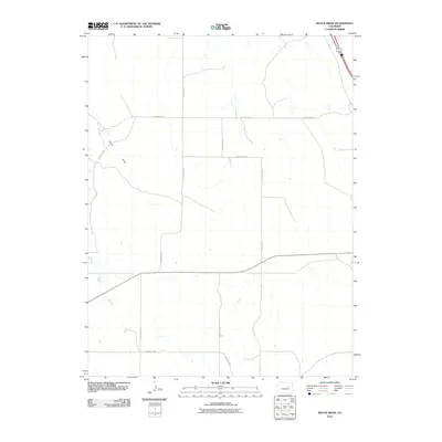
2010 Map of Beuck Draw
USGS Topo · Published 2010About this map
Beuck Draw winds through this expanse of Elbert County, defining the drainage patterns of a landscape marked by a disciplined grid of rural section roads. This 2010 survey illustrates a sparsely populated agricultural region where transportation is dictated by a network of gravel and paved routes, including County Rd 153 and County Rd 157. The convergence of 40 287 and County Hwy 134 serves as a primary transit corridor through the plains. Small stock ponds and intermittent seasonal drainages are scattered throughout the quadrangle, reflecting the land's reliance on the periodic flow of water through the draws. The map captures the quiet character of the Colorado high plains, where large-scale land management and traditional ranching boundaries are evidenced by the long, straight stretches of County Rd 134 and County Rd 110.
Find a feature on this map
11 named features on this map. Tap any name to fly to it.
Don’t see what you’re looking for? This feature index may not catch every label — zoom into the map to look around manually.
Map Details
Editions of this 2010 Beuck Draw Map
This is the sole edition of this map. No revisions or reprints were ever made.
Other maps of this area

1891 · Limon
USGS Topo · 1:125,000

1892 · Limon
USGS Topo · 1:125,000

1953 · Denver
USGS Topo · 1:250,000

1954 · Limon
USGS Topo · 1:250,000

1957 · Denver
USGS Topo · 1:250,000

1957 · Limon
USGS Topo · 1:250,000

1958 · Limon
USGS Topo · 1:250,000

1958 · Denver
USGS Topo · 1:250,000

1960 · Denver
USGS Topo · 1:250,000

1970 · Agate
USGS Topo · 1:24,000