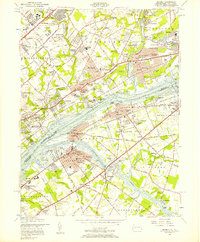
1955 Map of Beverly
USGS Topo · Published 1957About this map
The Delaware River serves as the central artery for this mid-century landscape, separating the industrializing riverfronts of Philadelphia County and Bucks County, Pennsylvania, from the burgeoning residential corridors of Burlington County, New Jersey. This era shows a dense concentration of institutional landmarks, including the sprawling Philadelphia State Hospital and several religious educational centers like the Holy Ghost Missionary College and Sacred Heart Convent. Significant river features such as Mud Island and Hawk Island remain prominent, while the confluence of Rancocas Creek at Riverside highlights the importance of water access for local transit and recreation. Inland, the map documents the transition from open space to post-war suburban development, seen in the planned streets of Croydon and the early layout of Willingboro, just as the Pennsylvania Pike was establishing new regional connections.
Find a feature on this map
169 named features on this map. Tap any name to fly to it.
Don’t see what you’re looking for? This feature index may not catch every label — zoom into the map to look around manually.
Map Details
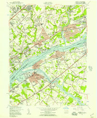
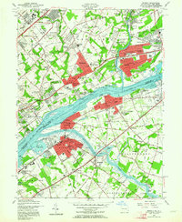
Editions of this 1955 Beverly Map
3 editions found
Other maps of this area

1888 · Mount Holly
USGS Topo · 1:62,500

1890 · Burlington
USGS Topo · 1:62,500

1891 · Philadelphia
USGS Topo · 1:62,500

1893 · Germantown
USGS Topo · 1:62,500

1893 · Burlington
USGS Topo · 1:62,500

1894 · Mount Holly
USGS Topo · 1:62,500

1894 · Philadelphia
USGS Topo · 1:62,500

1894 · Germantown
USGS Topo · 1:62,500

1896 · Germantown
USGS Topo · 1:62,500

1896 · Philadelphia
USGS Topo · 1:62,500
Featured Places
- Philadelphia, PA
- Bensalem Township, PA
- Mount Laurel Township, NJ
- Willingboro Township, NJ
- Moorestown Township, NJ