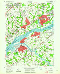
1955 Map of Beverly
USGS Topo · Published 1964About this map
The Delaware River serves as the central artery for this mid-century portrait of the Pennsylvania and New Jersey border, dividing the industrial and residential growth of Bensalem and Bristol from the riverfront communities of Beverly and Delran. The landscape is dominated by institutional footprints and early suburban expansion, notably the sprawling grounds of the Philadelphia State Hospital and the County Prison Farm near Linconia. Transport networks including the Pennsylvania Railroad and the Lincoln Highway dictate the development patterns of towns like Croydon and Cornwells Heights.
Find a feature on this map
141 named features on this map. Tap any name to fly to it.
Don’t see what you’re looking for? This feature index may not catch every label — zoom into the map to look around manually.
Map Details
Editions of this 1955 Beverly Map
3 editions found
Other maps of this area

1888 · Mount Holly
USGS Topo · 1:62,500

1890 · Burlington
USGS Topo · 1:62,500

1891 · Philadelphia
USGS Topo · 1:62,500

1893 · Germantown
USGS Topo · 1:62,500

1893 · Burlington
USGS Topo · 1:62,500

1894 · Mount Holly
USGS Topo · 1:62,500

1894 · Philadelphia
USGS Topo · 1:62,500

1894 · Germantown
USGS Topo · 1:62,500

1896 · Germantown
USGS Topo · 1:62,500

1896 · Philadelphia
USGS Topo · 1:62,500
Featured Places
- Philadelphia, PA
- Bensalem Township, PA
- Mount Laurel Township, NJ
- Willingboro Township, NJ
- Moorestown Township, NJ