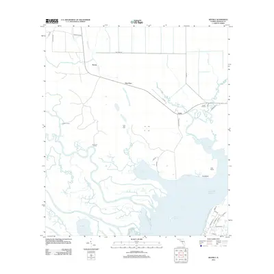
2012 Map of Beverly
USGS Topo · Published 2012About this map
The labyrinthine wetlands of the Gulf of Mexico coastline dominate this portion of Franklin County, where the Saint Marks River and Little Saint Marks River reach the tidal flats. Small settlements and specialized camps such as Beverly, Creels, and Creels Side Camp are scattered across the lowlands, connected by a network of rural routes including Pitts Rd and Tower Rd. The map reveals the intricate drainage patterns of the coastal plain, characterized by strangely named waterways like Thankyoumaam Cr, Whiskey George Cr, and the Montgomery Slough.
Find a feature on this map
50 named features on this map. Tap any name to fly to it.
Don’t see what you’re looking for? This feature index may not catch every label — zoom into the map to look around manually.
Map Details
Editions of this 2012 Beverly Map
This is the sole edition of this map. No revisions or reprints were ever made.
Other maps of this area

1943 · West Pass
USGS Topo · 1:31,680

1943 · Apalachicola
USGS Topo · 1:31,680

1943 · Jackson River
USGS Topo · 1:24,000

1944 · Green Point
USGS Topo · 1:31,680

1944 · Apalachicola
USGS Topo · 1:24,000

1944 · Forbes Island
USGS Topo · 1:24,000

1945 · Forbes Island
USGS Topo · 1:31,680

1945 · Tates Hell Swamp
USGS Topo · 1:31,680

1945 · Beverly
USGS Topo · 1:31,680

1945 · Jackson River
USGS Topo · 1:31,680