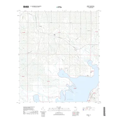
2018 Map of Beverly
USGS Topo · Published 2018About this map
East Bay and the surrounding marshlands of Franklin County define this coastal landscape, where the Saint Marks River and Little Saint Marks River meet the Gulf of Mexico. The area is a complex network of tidal channels and sloughs, including the East River Cut Off and Montgomery Slough, which bypass established water bodies like Chipley Lake and Blounts Bay. Small coastal settlements such as Beverly, Creels, and Hays Place are linked by rural routes like N Shore Bay Rd, reflecting the sparse but enduring presence of communities along these bayous.
Find a feature on this map
57 named features on this map. Tap any name to fly to it.
Don’t see what you’re looking for? This feature index may not catch every label — zoom into the map to look around manually.
Map Details
Editions of this 2018 Beverly Map
This is the sole edition of this map. No revisions or reprints were ever made.
Other maps of this area

1943 · West Pass
USGS Topo · 1:31,680

1943 · Apalachicola
USGS Topo · 1:31,680

1943 · Jackson River
USGS Topo · 1:24,000

1944 · Green Point
USGS Topo · 1:31,680

1944 · Apalachicola
USGS Topo · 1:24,000

1944 · Forbes Island
USGS Topo · 1:24,000

1945 · Forbes Island
USGS Topo · 1:31,680

1945 · Tates Hell Swamp
USGS Topo · 1:31,680

1945 · Beverly
USGS Topo · 1:31,680

1945 · Jackson River
USGS Topo · 1:31,680