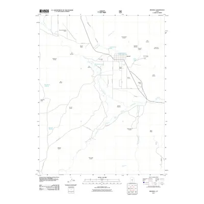
2011 Map of Bicknell
USGS Topo · Published 2011About this map
Bicknell serves as the central hub of this landscape, positioned in Rabbit Valley where the Fremont River winds through the high-elevation terrain. This 2011 survey captures a complex network of water management features essential to the region, including the High Line Ditch, Spring Ditch, and several reservoirs such as Big Hollow Reservoir and Bicknell Reservoir. The local infrastructure is well-defined, from the Bicknell Post Office in the town center to the Wayne Wonderland Airport to the northwest. To the east, the terrain transitions into dramatic geological features like Red Canyon and East Fork Red Canyon. Genealogists and local historians can locate the Bicknell Cemetery southeast of town, while the surrounding canyons and hollows, such as Cottonwood Canyon and Sam Legg Hollow, reveal the extent of family-named landmarks and historical grazing or transit routes across the plateau.
Find a feature on this map
49 named features on this map. Tap any name to fly to it.
Don’t see what you’re looking for? This feature index may not catch every label — zoom into the map to look around manually.
Map Details
Editions of this 2011 Bicknell Map
This is the sole edition of this map. No revisions or reprints were ever made.
Other maps of this area

1885 · Fish Lake
USGS Topo · 1:250,000

1896 · Fish Lake
USGS Topo · 1:250,000

1952 · Notom 2 NW
USGS Topo · 1:24,000

1952 · Loa 1 SE
USGS Topo · 1:24,000

1952 · Notom 3 NW
USGS Topo · 1:24,000

1952 · Notom 2 SW
USGS Topo · 1:24,000

1952 · Grover
USGS Topo · 1:62,500

1952 · Torrey
USGS Topo · 1:62,500

1952 · Loa 1 NE
USGS Topo · 1:24,000

1953 · Loa 4 NE
USGS Topo · 1:24,000