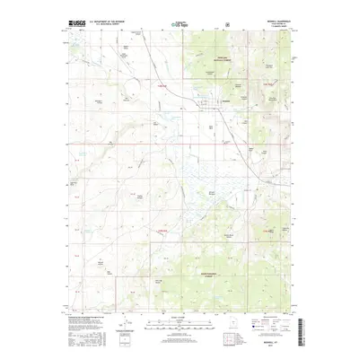
2017 Map of Bicknell
USGS Topo · Published 2017About this map
Bicknell lies at the heart of Rabbit Valley, situated where the Fremont River creates the marshy wetlands of the Bicknell Bottoms. This high-desert landscape is defined by its transition from the valley floor to the elevations of the Fishlake National Forest in the north and the Dixie National Forest to the south. The agricultural character of the area is evident in the network of irrigation features like the High Line Ditch and Spring Ditch, which support several named ponds including West Bicknell Pond and the East Bicknell Sand-Wash Pond. To the west, the Wayne Wonderland Airport provides a remote aviation link, while the surrounding terrain is marked by numerous canyons and draws, such as Blackburn Hollow and Wildcat Hollow. Significant landmarks like Thousand Lake Mtn and Black Ridge dominate the horizon, framing a community still tied to its water sources and ranching roots.
Find a feature on this map
98 named features on this map. Tap any name to fly to it.
Don’t see what you’re looking for? This feature index may not catch every label — zoom into the map to look around manually.
Map Details
Editions of this 2017 Bicknell Map
This is the sole edition of this map. No revisions or reprints were ever made.
Other maps of this area

1885 · Fish Lake
USGS Topo · 1:250,000

1896 · Fish Lake
USGS Topo · 1:250,000

1952 · Notom 2 NW
USGS Topo · 1:24,000

1952 · Loa 1 SE
USGS Topo · 1:24,000

1952 · Notom 3 NW
USGS Topo · 1:24,000

1952 · Notom 2 SW
USGS Topo · 1:24,000

1952 · Grover
USGS Topo · 1:62,500

1952 · Torrey
USGS Topo · 1:62,500

1952 · Loa 1 NE
USGS Topo · 1:24,000

1953 · Loa 4 NE
USGS Topo · 1:24,000