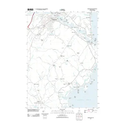
2011 Map of Biddeford
USGS Topo · Published 2011About this map
Biddeford and Saco are the urban anchors of this coastal landscape, separated by the industrial reach of the Saco River and its varied islands, including Factory Island and Springs Island. The river’s power is harnessed by the Cataract Dam and West Channel Dam, pointing to the area's manufacturing legacy near Whites Wharf. Beyond the city centers, the landscape transitions into a series of locally named crossroads such as Tattle Corner, Guinea Corner, and Tea Kettle Corner, which likely mark historic neighborhood hubs.
Find a feature on this map
171 named features on this map. Tap any name to fly to it.
Don’t see what you’re looking for? This feature index may not catch every label — zoom into the map to look around manually.
Map Details
Editions of this 2011 Biddeford Map
This is the sole edition of this map. No revisions or reprints were ever made.
Other maps of this area

1891 · Portland
USGS Topo · 1:62,500

1891 · Biddeford
USGS Topo · 1:62,500

1891 · Kennebunk
USGS Topo · 1:62,500

1891 · Buxton
USGS Topo · 1:62,500

1892 · Buxton
USGS Topo · 1:62,500

1893 · Kennebunk
USGS Topo · 1:62,500

1893 · Biddeford
USGS Topo · 1:62,500

1893 · Portland
USGS Topo · 1:62,500

1893 · Buxton
USGS Topo · 1:62,500

1898 · Kennebunk
USGS Topo · 1:62,500