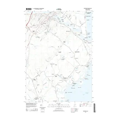
2014 Map of Biddeford
USGS Topo · Published 2014About this map
Factory Island and Springs Island anchor the industrial and civic heart of Biddeford where the Saco River meets the sea. This coastal landscape is defined by a series of distinct crossroads and residential clusters, ranging from Five Points and Newtown inland to the seaside communities of Fortunes Rocks, Hills Beach, and Camp Ellis. The map illustrates a complex relationship between land and water, featuring several aviation facilities like the Biddeford Municipal Airport and Goosefair Airport alongside traditional maritime landmarks such as Ferry Beach and Goose Rocks Beach. Genealogists will find a wealth of data in the numerous burial grounds, including Laurel Hill Cem, Saint Marys Cem, and Woodlawn Cem. The southern extent of the sheet reaches toward Cape Porpoise, capturing the winding course of the Batson River and the Batson River Reservoir.
Find a feature on this map
154 named features on this map. Tap any name to fly to it.
Don’t see what you’re looking for? This feature index may not catch every label — zoom into the map to look around manually.
Map Details
Editions of this 2014 Biddeford Map
This is the sole edition of this map. No revisions or reprints were ever made.
Other maps of this area

1891 · Portland
USGS Topo · 1:62,500

1891 · Biddeford
USGS Topo · 1:62,500

1891 · Kennebunk
USGS Topo · 1:62,500

1891 · Buxton
USGS Topo · 1:62,500

1892 · Buxton
USGS Topo · 1:62,500

1893 · Kennebunk
USGS Topo · 1:62,500

1893 · Biddeford
USGS Topo · 1:62,500

1893 · Portland
USGS Topo · 1:62,500

1893 · Buxton
USGS Topo · 1:62,500

1898 · Kennebunk
USGS Topo · 1:62,500