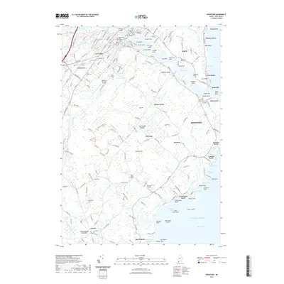
2021 Map of Biddeford
USGS Topo · Published 2021About this map
Factory Island and Springs Island sit at the heart of the Saco River, marking the industrial and civic center where Saco and Biddeford meet. This coastal portrait illustrates the dense urban grid of the twin cities, reaching from Five Points out to the sprawling marshes of the Great Heath. The landscape is a mix of established residential neighborhoods and significant institutions, including the University of New England and several large burial grounds such as Laurel Hill Cem and Saint Josephs Cem. Along the Atlantic shoreline, the character shifts to a string of coastal settlements and beaches. From the rocky points at Cape Porpoise and Fortunes Rocks to the sandy reaches of Goose Rocks Beach and Ferry Beach, the map captures the transition from the river-driven economy of the interior to the seasonal and maritime life of the York County coast.
Find a feature on this map
223 named features on this map. Tap any name to fly to it.
Don’t see what you’re looking for? This feature index may not catch every label — zoom into the map to look around manually.
Map Details
Editions of this 2021 Biddeford Map
This is the sole edition of this map. No revisions or reprints were ever made.
Other maps of this area

1891 · Portland
USGS Topo · 1:62,500

1891 · Biddeford
USGS Topo · 1:62,500

1891 · Kennebunk
USGS Topo · 1:62,500

1891 · Buxton
USGS Topo · 1:62,500

1892 · Buxton
USGS Topo · 1:62,500

1893 · Kennebunk
USGS Topo · 1:62,500

1893 · Biddeford
USGS Topo · 1:62,500

1893 · Portland
USGS Topo · 1:62,500

1893 · Buxton
USGS Topo · 1:62,500

1898 · Kennebunk
USGS Topo · 1:62,500