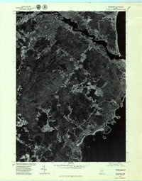
1975 Map of Biddeford
USGS Topo · Published 1979About this map
Biddeford and the surrounding coastal landscape of York County are captured here during the mid-1970s. This orthophotoquad, produced from 1975 aerial photography, emphasizes the distinct contrast between the developed urban centers and the irregular, winding woodlots and fields that characterize the Maine coast. The image-based format provides a unique perspective on the settlement patterns near Saco and the smaller crossroads of Guinea Road Corner. Along the jagged shoreline, the geography of Fortunes Rocks and the marshy outlets near Cape Porpoise reveal the relationship between tidal inlets and human habitation. Researchers can trace the path of the Little River as it meanders toward the Atlantic Ocean, as well as the extent of development in Arundel at a time when the region was balancing its industrial heritage with its coastal residential growth.
Find a feature on this map
9 named features on this map. Tap any name to fly to it.
Don’t see what you’re looking for? This feature index may not catch every label — zoom into the map to look around manually.
Map Details
Editions of this 1975 Biddeford Map
This is the sole edition of this map. No revisions or reprints were ever made.
Other maps of this area

1891 · Portland
USGS Topo · 1:62,500

1891 · Biddeford
USGS Topo · 1:62,500

1891 · Kennebunk
USGS Topo · 1:62,500

1891 · Buxton
USGS Topo · 1:62,500

1892 · Buxton
USGS Topo · 1:62,500

1893 · Kennebunk
USGS Topo · 1:62,500

1893 · Biddeford
USGS Topo · 1:62,500

1893 · Portland
USGS Topo · 1:62,500

1893 · Buxton
USGS Topo · 1:62,500

1898 · Kennebunk
USGS Topo · 1:62,500