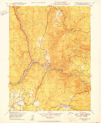
1950 Map of Bidwell Bar
USGS Topo · Published 1950About this map
The North Fork Feather River, Middle Fork Feather River, and South Fork Feather River converge in this 1950 topographical study, revealing the complex water management and gold-era geography of Butte County. The landscape is defined by its bars—depositional river features that served as critical mining sites—including Montgomery Bar, Miller Bar, and Stringtown Bar. Infrastructure such as the Palermo Canal, a Siphon, and a Flume trace the movement of water across the ridges, supporting the region's agricultural and mining interests.
Find a feature on this map
51 named features on this map. Tap any name to fly to it.
Don’t see what you’re looking for? This feature index may not catch every label — zoom into the map to look around manually.
Map Details
Editions of this 1950 Bidwell Bar Map
2 editions found
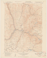
Other maps of this area

1888 · Marysville
USGS Topo · 1:125,000

1888 · Smartsville
USGS Topo · 1:125,000

1888 · Bidwell Bar
USGS Topo · 1:125,000

1891 · Bidwell Bar
USGS Topo · 1:125,000

1891 · Chico
USGS Topo · 1:125,000

1891 · Marysville
USGS Topo · 1:125,000

1891 · Smartsville
USGS Topo · 1:125,000

1892 · Smartsville
USGS Topo · 1:125,000

1893 · Chico
USGS Topo · 1:125,000

1893 · Bidwell Bar
USGS Topo · 1:125,000