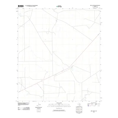
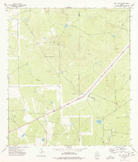
2010 Map of Biel Lake SE
USGS Topo · Published 2010About this map
Brush-covered terrain and ephemeral drainages define this portion of Webb County in South Texas as it appeared in the early 21st century. The landscape is primarily shaped by ranching infrastructure and local hydrology, with numerous small stock tanks and unnamed seasonal creek beds scattered across the quadrangle. Transport through this sparsely populated cattle country is anchored by FM 2050, which cuts diagonally across the southern half of the sheet. This route provides the primary connection for local landholders and agricultural operations in an area characterized by large-scale land parcels and a grid of private ranch roads that service the interior territory.
Find a feature on this map
1 named feature on this map. Tap any name to fly to it.
Don’t see what you’re looking for? This feature index may not catch every label — zoom into the map to look around manually.
Map Details
Editions of this 2010 Biel Lake SE Map
This is the sole edition of this map. No revisions or reprints were ever made.
Other maps of this area

1956 · Freer
USGS Topo · 1:62,500

1956 · Las Mujeres
USGS Topo · 1:62,500

1956 · Laredo
USGS Topo · 1:250,000

1968 · Mills Bennett
USGS Topo · 1:24,000

1968 · Parrilla Creek NW
USGS Topo · 1:24,000

1968 · Mills Bennett NW
USGS Topo · 1:24,000
1971 · Freer NW
USGS Topo · 1:24,000
1971 · Sarnosa Hill
USGS Topo · 1:24,000
1973 · Biel Lake North
USGS Topo · 1:24,000
1974 · Biel Lake SE
USGS Topo · 1:24,000