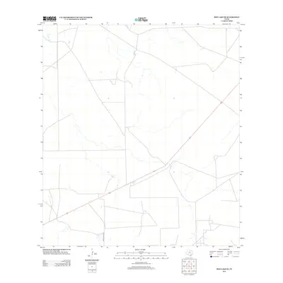
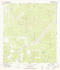
2013 Map of Biel Lake SE
USGS Topo · Published 2013About this map
Arid ranchlands of Webb County define this South Texas landscape, where ephemeral drainages cut through a network of rural fencing and property boundaries. The transportation infrastructure is dominated by Ranch Road 2050, which enters from the south and provides a primary artery through this sparsely settled territory. The map reveals the intricate grid-like pattern of property access roads and livestock pens typical of large-scale Texas ranching operations, showcasing how the environment has been partitioned for grazing. This 2013 survey serves as a clear record of the region's land use before major changes in industrial development or subdivision, preserving the footprint of the traditional cattle country near the Mexican border.
Find a feature on this map
1 named feature on this map. Tap any name to fly to it.
Don’t see what you’re looking for? This feature index may not catch every label — zoom into the map to look around manually.
Map Details
Editions of this 2013 Biel Lake SE Map
This is the sole edition of this map. No revisions or reprints were ever made.
Other maps of this area

1956 · Freer
USGS Topo · 1:62,500

1956 · Las Mujeres
USGS Topo · 1:62,500

1956 · Laredo
USGS Topo · 1:250,000

1968 · Mills Bennett
USGS Topo · 1:24,000

1968 · Parrilla Creek NW
USGS Topo · 1:24,000

1968 · Mills Bennett NW
USGS Topo · 1:24,000
1971 · Freer NW
USGS Topo · 1:24,000
1971 · Sarnosa Hill
USGS Topo · 1:24,000
1973 · Biel Lake North
USGS Topo · 1:24,000
1974 · Biel Lake SE
USGS Topo · 1:24,000