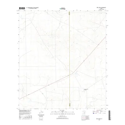
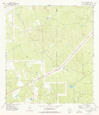
2016 Map of Biel Lake SE
USGS Topo · Published 2016About this map
Arroyo de Charco Escondido winds through this South Texas landscape, marking a significant drainage path in the brush country of Webb County. The terrain is defined by a series of northwest-to-southeast ridges and valleys, with elevations rising above 600 feet in the northeastern corner. Transportation through this rural area is anchored by the diagonal corridor of Highway 59 and its junction with Fm 2050. The map documents the boundary line between Webb Co and Duval Co, showing the surveyed parcel lines and ranch roads that partition the land. This 2016 survey captures the contemporary state of these large-scale land holdings and the hydrological network that sustains them before any further modern development altered the drainage patterns of the arroyos.
Find a feature on this map
4 named features on this map. Tap any name to fly to it.
Don’t see what you’re looking for? This feature index may not catch every label — zoom into the map to look around manually.
Map Details
Editions of this 2016 Biel Lake SE Map
This is the sole edition of this map. No revisions or reprints were ever made.
Other maps of this area

1956 · Freer
USGS Topo · 1:62,500

1956 · Las Mujeres
USGS Topo · 1:62,500

1956 · Laredo
USGS Topo · 1:250,000

1968 · Mills Bennett
USGS Topo · 1:24,000

1968 · Parrilla Creek NW
USGS Topo · 1:24,000

1968 · Mills Bennett NW
USGS Topo · 1:24,000
1971 · Freer NW
USGS Topo · 1:24,000
1971 · Sarnosa Hill
USGS Topo · 1:24,000
1973 · Biel Lake North
USGS Topo · 1:24,000
1974 · Biel Lake SE
USGS Topo · 1:24,000