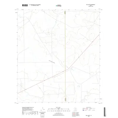
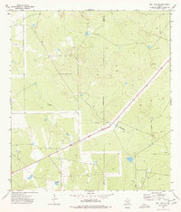
2019 Map of Biel Lake SE
USGS Topo · Published 2019About this map
The Webb and Duval county line marks the vertical axis of this South Texas landscape, defined by the dry drainage patterns of the Brush Country. The ephemeral Arroyo de Charco Escondido meanders across the central terrain, providing a critical geographic marker for land tracking in this arid region. Transportation and property access are anchored by the intersection of 59 and Fm 2050, showing the modern connectivity of these sprawling ranchlands. This survey is particularly useful for understanding the relief and natural drainage features of the borderlands where the coastal plains begin to rise into the South Texas interior.
Find a feature on this map
4 named features on this map. Tap any name to fly to it.
Don’t see what you’re looking for? This feature index may not catch every label — zoom into the map to look around manually.
Map Details
Editions of this 2019 Biel Lake SE Map
This is the sole edition of this map. No revisions or reprints were ever made.
Other maps of this area

1956 · Freer
USGS Topo · 1:62,500

1956 · Las Mujeres
USGS Topo · 1:62,500

1956 · Laredo
USGS Topo · 1:250,000

1968 · Mills Bennett
USGS Topo · 1:24,000

1968 · Parrilla Creek NW
USGS Topo · 1:24,000

1968 · Mills Bennett NW
USGS Topo · 1:24,000
1971 · Freer NW
USGS Topo · 1:24,000
1971 · Sarnosa Hill
USGS Topo · 1:24,000
1973 · Biel Lake North
USGS Topo · 1:24,000
1974 · Biel Lake SE
USGS Topo · 1:24,000