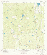
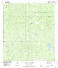
1974 Map of Biel Lake South
USGS Topo · Published 1977About this map
Talvez Oil Field anchors the southeastern corner of this landscape, illustrating the industrial energy footprint in Webb County during the mid-1970s. The terrain is defined by a dendritic network of seasonal drainages, most notably Black Creek and the long, winding Mesquitoso Creek, which flow toward Biel Lake in the north. This survey captures a rural Texas ranching environment where water management is central to the land's utility, marked by numerous small tanks and the La Volanta Windmill.
Find a feature on this map
11 named features on this map. Tap any name to fly to it.
Don’t see what you’re looking for? This feature index may not catch every label — zoom into the map to look around manually.
Map Details
Editions of this 1974 Biel Lake South Map
This is the sole edition of this map. No revisions or reprints were ever made.
Other maps of this area

1937 · Aguilete Creek
USGS Topo · 1:62,500

1956 · Becerra
USGS Topo · 1:62,500

1956 · Las Mujeres
USGS Topo · 1:62,500

1956 · Laredo
USGS Topo · 1:250,000

1968 · Mills Bennett
USGS Topo · 1:24,000

1968 · Mills Bennett NW
USGS Topo · 1:24,000
1973 · Biel Lake North
USGS Topo · 1:24,000
1974 · Biel Lake SE
USGS Topo · 1:24,000
1974 · Biel Lake NE
USGS Topo · 1:24,000
1980 · Alamito Creek
USGS Topo · 1:24,000