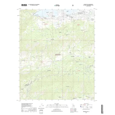
2018 Map of Big Bear Lake
USGS Topo · Published 2018About this map
Big Bear Lake and the high ridges of the San Bernardino National Forest dominate this landscape, reflecting a region defined by recreational development and steep drainage basins. The northern half of the sheet captures the concentrated settlement around Big Bear Lake, including the communities of Boulder Bay and the specialized trails at Snow Summit. Moving south, the terrain drops dramatically into the Santa Ana River canyon and the Mill Creek Road corridor, where smaller enclaves like Seven Oaks, Pinezanita, and Angelus Oaks are found. The map provides a clear look at the network of fire roads and trails, such as Clarks Grade and Sugarloaf Truck Trl, which connect the lake's shores to the high peaks of the San Bernardino Mountain range. This survey illustrates the intricate relationship between the watershed's natural springs, such as Columbine Spring, and the historic forest management access points like Barton Flats.
Find a feature on this map
101 named features on this map. Tap any name to fly to it.
Don’t see what you’re looking for? This feature index may not catch every label — zoom into the map to look around manually.
Map Details
Editions of this 2018 Big Bear Lake Map
This is the sole edition of this map. No revisions or reprints were ever made.
Other maps of this area

1899 · Redlands
USGS Topo · 1:62,500

1901 · Southern California Sheet No. 1
USGS Topo · 1:250,000

1901 · Redlands
USGS Topo · 1:62,500

1902 · Deep Creek
USGS Topo · 1:62,500

1902 · San Gorgonio
USGS Topo · 1:125,000

1904 · Southern California Sheet No. 1
USGS Topo · 1:250,000

1947 · Lucerne Valley
USGS Topo · 1:62,500

1949 · Lucerne Valley
USGS Topo · 1:62,500

1953 · San Bernardino
USGS Topo · 1:250,000
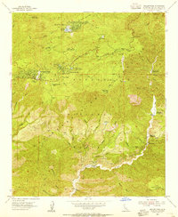
1953 · Keller Peak
USGS Topo · 1:24,000