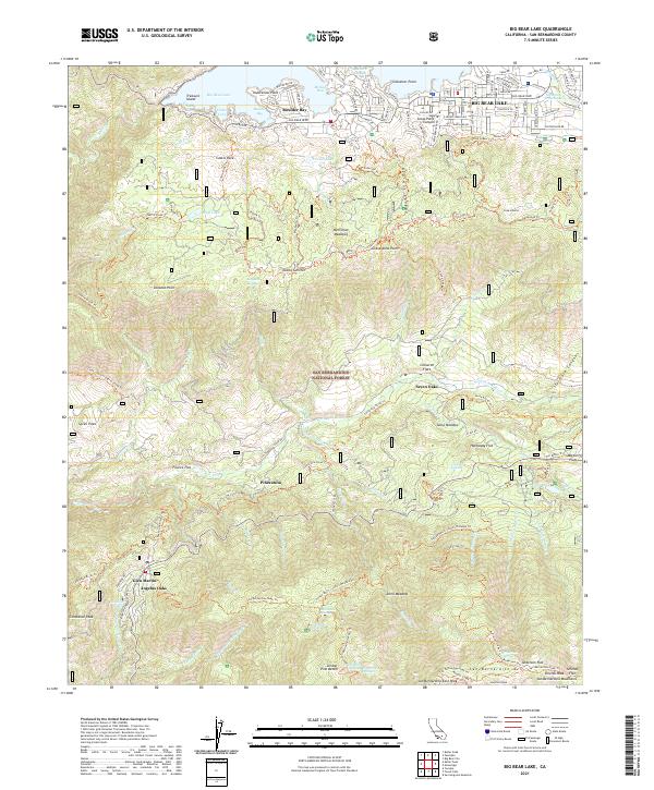
2021 Map of Big Bear Lake
USGS Topo · Published 2021About this map
Big Bear Lake serves as the focal point of this high-elevation landscape within the San Bernardino National Forest. The map details the developed northern shoreline, from the residential clusters at Boulder Bay to the coves and points like Kidd Cove and Gibralter Point. Moving south across the peaks of the San Bernardino Mtn, the terrain shifts to a network of creeks and remote flats. Small settlements and mountain communities such as Angelus Oaks, Seven Oaks, and Barton Flats are situated along the winding roads and canyon floors. The drainage of the Santa Ana River dominates the central valley, supported by numerous springs and small alpine lakes including Jenks Lake and Bluff Lake. An extensive trail system, including the Skyline Trl and Siberia Creek Trl, connects the various summits and meadows, illustrating the area's long-standing character as a recreational and wilderness retreat.
Find a feature on this map
88 named features on this map. Tap any name to fly to it.
Don’t see what you’re looking for? This feature index may not catch every label — zoom into the map to look around manually.
Map Details
Editions of this 2021 Big Bear Lake Map
This is the sole edition of this map. No revisions or reprints were ever made.
Other maps of this area

1899 · Redlands
USGS Topo · 1:62,500

1901 · Southern California Sheet No. 1
USGS Topo · 1:250,000

1901 · Redlands
USGS Topo · 1:62,500

1902 · Deep Creek
USGS Topo · 1:62,500

1902 · San Gorgonio
USGS Topo · 1:125,000

1904 · Southern California Sheet No. 1
USGS Topo · 1:250,000

1947 · Lucerne Valley
USGS Topo · 1:62,500

1949 · Lucerne Valley
USGS Topo · 1:62,500

1953 · San Bernardino
USGS Topo · 1:250,000
1953 · Keller Peak
USGS Topo · 1:24,000