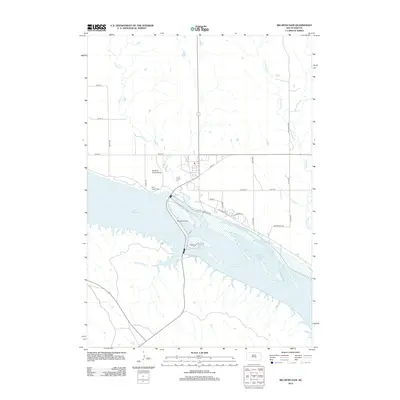
2012 Map of Big Bend Dam
USGS Topo · Published 2012About this map
Big Bend Dam serves as the central focal point of this Missouri River landscape, dividing the waters of Lake Sharpe to the northwest from Lake Francis Case to the southeast. This 2012 survey documents the complex water management infrastructure and road network at the meeting point of Buffalo County and Lyman County. North of the dam, the Big Bend Landing Strip and Saint Joseph Cem are situated near the banks of the reservoir. The surrounding terrain is dissected by several named drainages, including Soldier Cr, Good Soldier Cr, and Campbell Cr. Local transportation is defined by a grid of rural routes such as Bad Nation Rd and the historically evocative Old Fort Thompson Rd, which parallels the northern shoreline of the river system.
Find a feature on this map
23 named features on this map. Tap any name to fly to it.
Don’t see what you’re looking for? This feature index may not catch every label — zoom into the map to look around manually.
Map Details
Editions of this 2012 Big Bend Dam Map
This is the sole edition of this map. No revisions or reprints were ever made.
Other maps of this area

1935 · Chamberlain
USGS Topo · 1:62,500

1939 · Chamberlain
USGS Topo · 1:62,500

1953 · Huron
USGS Topo · 1:250,000

1954 · Huron
USGS Topo · 1:250,000

1955 · Mitchell
USGS Topo · 1:250,000

1959 · Mitchell
USGS Topo · 1:250,000

1966 · Big Bend Dam NE
USGS Topo · 1:24,000

1966 · Big Bend Dam SE
USGS Topo · 1:24,000

1966 · Stephan
USGS Topo · 1:24,000

1966 · Big Bend Dam
USGS Topo · 1:24,000
Featured Places
- Wilson Township, Crow Creek District
- Victory East Township, SD
- Fort Thompson, Fort Thompson District
- Fort Thompson District, SD
- Grey Hill East Township, Fort Thompson District