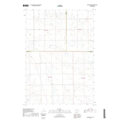
2017 Map of Big Bend Dam NE
USGS Topo · Published 2017About this map
The rolling plains at the intersection of Hyde, Hand, and Buffalo counties are defined by a network of drainage systems feeding into the Missouri River basin. This survey illustrates the rural landscape near the Big Bend of the Missouri, where watercourses like Elm Cr and its W Fork Elm Cr carve through the prairie. The map shows the section-line road grid characteristic of the Great Plains, including 343rd Ave and 345th Ave, which provide access to the expansive agricultural tracts that dominate this region. In the southern portion of the quadrangle, Wolf Cr and Sand Cr indicate the watershed's progression toward the river. Local infrastructure is minimal, consisting of rural routes such as Co Rd 958 and Lees Blvd, highlighting the low-density settlement pattern of these South Dakota townships in the early 21st century.
Find a feature on this map
20 named features on this map. Tap any name to fly to it.
Don’t see what you’re looking for? This feature index may not catch every label — zoom into the map to look around manually.
Map Details
Editions of this 2017 Big Bend Dam NE Map
This is the sole edition of this map. No revisions or reprints were ever made.
Other maps of this area

1953 · Huron
USGS Topo · 1:250,000

1954 · Huron
USGS Topo · 1:250,000

1966 · Big Bend Dam NE
USGS Topo · 1:24,000

1966 · Big Bend Dam SE
USGS Topo · 1:24,000

1966 · Stephan
USGS Topo · 1:24,000

1966 · Big Bend Dam
USGS Topo · 1:24,000

1973 · Miller Dale Colony SW
USGS Topo · 1:24,000

1973 · Big Bend Dam 4 NW
USGS Topo · 1:24,000

1973 · Macs Corner SE
USGS Topo · 1:24,000
1973 · Big Bend Dam 4 SW
USGS Topo · 1:24,000
Featured Places
- Arlington Township, SD
- Fort Thompson District, SD
- Grey Hill East Township, Fort Thompson District
- Buffalo County, SD
- Hand County, SD