
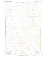
1966 Map of Big Bend Dam NE
USGS Topo · Published 1967About this map
The Crow Creek Indian Reservation Boundary bisects this landscape of the Missouri River Basin during the mid-1960s. The terrain is defined by the intricate drainages of Elm Creek, Wolf Creek, and West Fork Elm Creek, which carve through the plains at the intersection of Hyde, Hand, and Buffalo Counties. Evidence of local ranching and rural education is anchored by the Knippling Ranch and Curtis Sch, providing specific points of interest for genealogists and local historians tracing family ties to this region. The label Como appears in the northern portion of the map, marking a specific locale within the sprawling prairie. This survey, conducted as part of the Department of the Interior's program for development in the Missouri River Basin, meticulously records the fence lines and unimproved roads that connected these isolated homesteads and landmarks.
Find a feature on this map
11 named features on this map. Tap any name to fly to it.
Don’t see what you’re looking for? This feature index may not catch every label — zoom into the map to look around manually.
Map Details
Editions of this 1966 Big Bend Dam NE Map
This is the sole edition of this map. No revisions or reprints were ever made.
Other maps of this area

1953 · Huron
USGS Topo · 1:250,000

1954 · Huron
USGS Topo · 1:250,000

1966 · Big Bend Dam SE
USGS Topo · 1:24,000

1966 · Stephan
USGS Topo · 1:24,000

1966 · Big Bend Dam
USGS Topo · 1:24,000

1973 · Miller Dale Colony SW
USGS Topo · 1:24,000

1973 · Big Bend Dam 4 NW
USGS Topo · 1:24,000

1973 · Macs Corner SE
USGS Topo · 1:24,000
1973 · Big Bend Dam 4 SW
USGS Topo · 1:24,000

1973 · Macs Corner
USGS Topo · 1:24,000
Featured Places
- Fort Thompson District, SD
- Grey Hill East Township, Fort Thompson District
- Arlington Township, SD
- Buffalo County, SD
- Hand County, SD