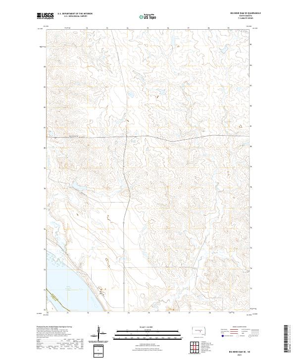
2021 Map of Big Bend Dam SE
USGS Topo · Published 2021About this map
Lake Francis Case dominates the southwestern corner of this quadrangle, representing the expansive reach of the Missouri River reservoir system along the border of Buffalo and Lyman Counties. The surrounding landscape is characterized by the complex drainage patterns of Wolf Creek and Campbell Creek, which carve through the high plains terrain. This 2021 survey illustrates the modern transportation network supporting the region's rural and tribal lands, anchored by BIA Hwy 4 and the long, straight stretch of Bad Nation Rd. The map provides a precise look at the township and range system, including t107n r71w and t108n r70w, which organize the sparsely populated ranching and agricultural land. Local infrastructure is reflected in named corridors such as Hereford Ln and 225th St, which connect remote homesteads to the primary thoroughfares.
Find a feature on this map
14 named features on this map. Tap any name to fly to it.
Don’t see what you’re looking for? This feature index may not catch every label — zoom into the map to look around manually.
Map Details
Editions of this 2021 Big Bend Dam SE Map
This is the sole edition of this map. No revisions or reprints were ever made.
Other maps of this area

1935 · Chamberlain
USGS Topo · 1:62,500

1939 · Chamberlain
USGS Topo · 1:62,500

1941 · Pukwana
USGS Topo · 1:62,500

1951 · Pukwana
USGS Topo · 1:62,500

1953 · Huron
USGS Topo · 1:250,000

1954 · Huron
USGS Topo · 1:250,000

1955 · Mitchell
USGS Topo · 1:250,000

1959 · Mitchell
USGS Topo · 1:250,000

1966 · Big Bend Dam NE
USGS Topo · 1:24,000

1966 · Big Bend Dam SE
USGS Topo · 1:24,000
Featured Places
- Grant West Township, Crow Creek District
- Grey Hill East Township, Fort Thompson District
- Fort Thompson District, SD
- Wilson Township, Crow Creek District
- Crow Creek District, SD