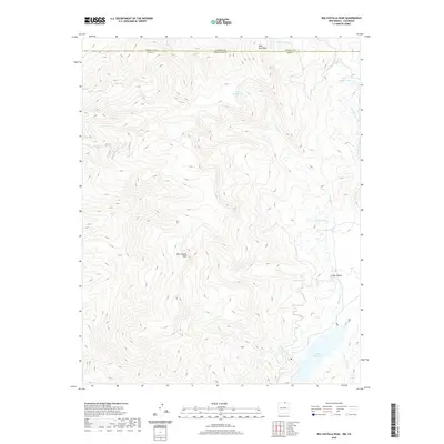
2020 Map of Big Costilla Peak
USGS Topo · Published 2020About this map
Big Costilla Peak dominates this high-altitude landscape along the border of New Mexico and Colorado, where the headwaters of the Sangre de Cristo Mountains form a complex drainage system. The terrain is defined by the Costilla Reservoir in the southeast and a network of glacial features, including the Glacier Lakes and uniquely named alpine basins like Lake Number One and Lake Number Two. Multiple tributaries, such as Costilla Cr, Casias Cr, and Sanhistevan Cr, carve through the steep relief, reflecting a watershed that has historically supported ranching and irrigation in the lower valleys. This map illustrates the intersection of Taos County, New Mexico, and Costilla County, Colorado, at State Line Peak, documenting a remote section of the southern Rockies where the environment remains shaped by significant elevations and seasonal water flow.
Find a feature on this map
19 named features on this map. Tap any name to fly to it.
Don’t see what you’re looking for? This feature index may not catch every label — zoom into the map to look around manually.
Map Details
Editions of this 2020 Big Costilla Peak Map
This is the sole edition of this map. No revisions or reprints were ever made.
Other maps of this area

1954 · Raton
USGS Topo · 1:250,000

1954 · Trinidad
USGS Topo · 1:250,000

1955 · Trinidad
USGS Topo · 1:250,000

1958 · Raton
USGS Topo · 1:250,000

1958 · Trinidad
USGS Topo · 1:250,000

1959 · Trinidad
USGS Topo · 1:250,000

1962 · Ash Mountain
USGS Topo · 1:62,500

1963 · Amalia
USGS Topo · 1:24,000

1963 · Latir Peak
USGS Topo · 1:24,000

1963 · Comanche Point
USGS Topo · 1:24,000