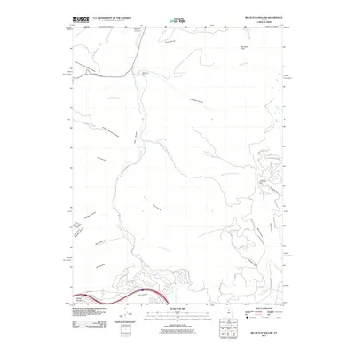
2011 Map of Big Dutch Hollow
USGS Topo · Published 2011About this map
Macfarlane Ranch and the distinctive structure of The Salt Box anchor this mountainous landscape in Summit County, where deep drainages like Big Dutch Hollow and Little Emigration Canyon carve through the terrain. The map details the transition from rural ranching roots to contemporary development, seen in the winding network of roads such as Jeremy Ranch Rd and Rasmussen Rd.
Find a feature on this map
57 named features on this map. Tap any name to fly to it.
Don’t see what you’re looking for? This feature index may not catch every label — zoom into the map to look around manually.
Map Details
Editions of this 2011 Big Dutch Hollow Map
This is the sole edition of this map. No revisions or reprints were ever made.
Other maps of this area

1885 · Salt Lake
USGS Topo · 1:250,000

1900 · Coalville
USGS Topo · 1:125,000

1903 · Coalville
USGS Topo · 1:125,000

1925 · Ft. Douglas
USGS Topo · 1:125,000

1928 · Ft. Douglas
USGS Topo · 1:125,000

1954 · Salt Lake City
USGS Topo · 1:250,000

1955 · Park City East
USGS Topo · 1:24,000

1955 · Mount Aire
USGS Topo · 1:24,000

1955 · Park City West
USGS Topo · 1:24,000

1958 · Salt Lake City
USGS Topo · 1:250,000