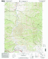
1998 Map of Big Dutch Hollow
USGS Topo · Published 2000About this map
The Mormon Pioneers Route cuts a definitive path through this mountainous landscape, tracing the historical migration corridor along East Canyon Creek. This late-twentieth-century revision highlights the convergence of frontier history and modern recreation, where the East Canyon State Park and the Jeremy Ranch Golf Course now occupy land once traversed by the Pony Express. Several historical markers, including those at Beuchmanns Pony Express Station and Mormon Flat, pinpoint the exact locations of significant nineteenth-century waypoints.
Find a feature on this map
40 named features on this map. Tap any name to fly to it.
Don’t see what you’re looking for? This feature index may not catch every label — zoom into the map to look around manually.
Map Details
Editions of this 1998 Big Dutch Hollow Map
This is the sole edition of this map. No revisions or reprints were ever made.
Other maps of this area

1885 · Salt Lake
USGS Topo · 1:250,000

1900 · Coalville
USGS Topo · 1:125,000

1903 · Coalville
USGS Topo · 1:125,000

1925 · Ft. Douglas
USGS Topo · 1:125,000

1928 · Ft. Douglas
USGS Topo · 1:125,000

1954 · Salt Lake City
USGS Topo · 1:250,000

1955 · Park City East
USGS Topo · 1:24,000

1955 · Mount Aire
USGS Topo · 1:24,000

1955 · Park City West
USGS Topo · 1:24,000

1958 · Salt Lake City
USGS Topo · 1:250,000