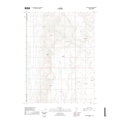
2018 Map of Big Hat Mountain
USGS Topo · Published 2018About this map
Big Hat Mtn dominates this high-desert terrain in Washoe County, a landscape defined by significant elevation changes and remote water sources. In a region where reliable water is scarce, numerous named springs such as Dip Spring, North Spring, and Rock Spring indicate the essential points of interest for early travelers and land users. The topography transitions from the dramatic peaks of the Hays Canyon Range down to Boulder Flat and the edges of Middle Alkali Lake in the west. Unusual geological formations are noted at The Craters and the perched Table Lakes, providing insight into the area's volcanic and hydrological character. To the south, the Black Canyon Reservoir and Black Canyon suggest modern water management in a territory primarily marked by canyons like Drag Road Canyon and Hog Gulch. This survey captures the specialized infrastructure of the Great Basin, where remote county roads like Co RD 37 are the primary lifelines through the high country.
Find a feature on this map
29 named features on this map. Tap any name to fly to it.
Don’t see what you’re looking for? This feature index may not catch every label — zoom into the map to look around manually.
Map Details
Editions of this 2018 Big Hat Mountain Map
This is the sole edition of this map. No revisions or reprints were ever made.
Other maps of this area

1886 · Alturas
USGS Topo · 1:250,000

1889 · Long Valley
USGS Topo · 1:250,000

1892 · Alturas
USGS Topo · 1:250,000

1954 · Vya
USGS Topo · 1:250,000

1954 · Alturas
USGS Topo · 1:250,000

1958 · Alturas
USGS Topo · 1:250,000

1958 · Vya
USGS Topo · 1:250,000

1962 · Alturas
USGS Topo · 1:250,000

1962 · Vya
USGS Topo · 1:250,000

1962 · Cedarville
USGS Topo · 1:62,500