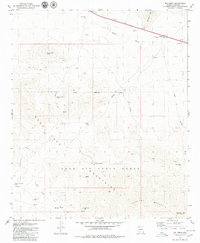
1979 Map of Big Horn
USGS Topo · Published 1979About this map
Javelina Mountain and the Maricopa Mts dominate this arid landscape in the late 1970s, a region defined by water scarcity and military presence. The southern portion of the map is occupied by the Luke Air Force Range, where numerous prospects and the Papago Indian Chief Mine indicate a history of mineral exploration. Water management is central to the area's geography, evidenced by features like Caesar Tank and various wells, including Sand Tank Well and several dry sites such as Raleigh Well (Dry). The drainage patterns of Bender Wash and Sand Tank Wash provide a natural structure to the desert terrain, while distinctive landmarks like Squaw Tits and Maricopa Peak offer clear navigational points across the open topography.
Find a feature on this map
20 named features on this map. Tap any name to fly to it.
Don’t see what you’re looking for? This feature index may not catch every label — zoom into the map to look around manually.
Map Details
Editions of this 1979 Big Horn Map
This is the sole edition of this map. No revisions or reprints were ever made.
Other maps of this area

1951 · Estrella
USGS Topo · 1:62,500

1951 · Gila Bend
USGS Topo · 1:62,500

1953 · Ajo
USGS Topo · 1:250,000

1957 · Ajo
USGS Topo · 1:250,000

1958 · Ajo
USGS Topo · 1:250,000

1958 · Kaka
USGS Topo · 1:62,500

1958 · Hat Mountain
USGS Topo · 1:62,500

1962 · Ajo
USGS Topo · 1:250,000

1963 · Ajo
USGS Topo · 1:250,000

1967 · Ajo
USGS Topo · 1:250,000