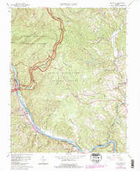
1965 Map of Big Island
USGS Topo · Published 1984About this map
James River water gaps and the rising slopes of the George Washington National Forest define this 1960s landscape as it transitions into the early 1980s. The Chesapeake and Ohio railroad tracks hug the northern bank of the river, passing through riverside settlements like Waugh, Big Island, and Pearch. High above the river valley, the Blue Ridge Parkway winds through the terrain, offering numerous vantage points such as the Otter Creek Flats Overlook and The Riffles Overlook. The mapping of this area captures a period where traditional rural life, anchored by places like Thornton Ch and Pedlar Mills, intersected with the growing recreational use of the mountains. Local landmarks like Holcomb Rock and the Otter Creek Recreation Area indicate how the natural features of the Pedlar River and surrounding peaks were integrated into the region's development.
Find a feature on this map
58 named features on this map. Tap any name to fly to it.
Don’t see what you’re looking for? This feature index may not catch every label — zoom into the map to look around manually.
Map Details
Editions of this 1965 Big Island Map
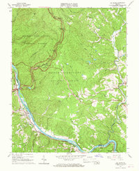
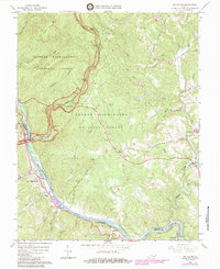
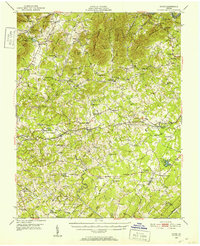
Other maps of this area

1892 · Lynchburg
USGS Topo · 1:125,000

1894 · Lexington
USGS Topo · 1:125,000

1935 · Buena Vista
USGS Topo · 1:48,000

1935 · Amherst
USGS Topo · 1:48,000

1939 · Amherst
USGS Topo · 1:62,500

1939 · Buena Vista
USGS Topo · 1:62,500

1940 · Buena Vista
USGS Topo · 1:62,500

1944 · Lynchburg
USGS Topo · 1:62,500

1947 · Roanoke
USGS Topo · 1:250,000
1950 · Goode
USGS Topo · 1:62,500