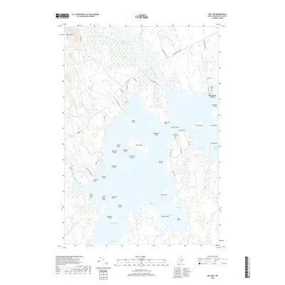
2018 Map of Big Lake
USGS Topo · Published 2018About this map
Peter Dana Point serves as a primary settlement hub on this part of the Maine landscape, situated where the waters of Big Lake meet the surrounding timberlands. The geography is defined by a complex network of glacial islands and peninsulas, including Epahsakom Island and Governors Point, which fragment the lake into numerous coves like Cass Cove and Clark Cove. This 2018 survey illustrates a land managed for both conservation and local industry, with the presence of The Pit Row near the northeastern shore and the historic Saint Annes Cem providing touchpoints for local genealogy and land use. The northern reaches are characterized by low-lying wetlands such as Stanhope Meadow and the slow-moving Lambs Deadwater, while Amazon Mtn rises to the northwest, offering a distinct contrast to the sprawling Bonney Swamp and the various stream outlets like Clifford Stream that feed the basin.
Find a feature on this map
76 named features on this map. Tap any name to fly to it.
Don’t see what you’re looking for? This feature index may not catch every label — zoom into the map to look around manually.
Map Details
Editions of this 2018 Big Lake Map
This is the sole edition of this map. No revisions or reprints were ever made.
Other maps of this area

1940 · Waite
USGS Topo · 1:62,500

1941 · Scraggly Lake
USGS Topo · 1:62,500

1941 · Big Lake
USGS Topo · 1:62,500

1941 · Wabassus Lake
USGS Topo · 1:62,500

1942 · Waite
USGS Topo · 1:62,500

1943 · Big Lake
USGS Topo · 1:62,500

1943 · Wabassus Lake
USGS Topo · 1:62,500

1944 · Scraggly Lake
USGS Topo · 1:62,500

1952 · Big Lake
USGS Topo · 1:50,000

1953 · Wabassus Lake
USGS Topo · 1:62,500
Featured Places
- Princeton, ME
- Indian Township / Motahkomikuk, ME
- Grand Lake Stream, ME
- Gould Landing, Greenlaw Chopping Township
- Big Lake Township, ME