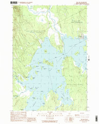
1990 Map of Big Lake
USGS Topo · Published 1990About this map
The Indian Twp Indian Reservation and the community at Peter Dana Point anchor the eastern reaches of this Washington County landscape. Dominated by the vast waters of Big Lake, the map reveals a complex network of islands and coves, including Taylor Island, Hardwood Island, and the secluded Rush Cove. The transition between organized and unorganized territories is clear, with the boundaries of Grand Lake Stream Plantation and Plantation No 21 defining the land use around the water.
Find a feature on this map
73 named features on this map. Tap any name to fly to it.
Don’t see what you’re looking for? This feature index may not catch every label — zoom into the map to look around manually.
Map Details
Editions of this 1990 Big Lake Map
This is the sole edition of this map. No revisions or reprints were ever made.
Other maps of this area

1940 · Waite
USGS Topo · 1:62,500

1941 · Scraggly Lake
USGS Topo · 1:62,500

1941 · Big Lake
USGS Topo · 1:62,500

1941 · Wabassus Lake
USGS Topo · 1:62,500

1942 · Waite
USGS Topo · 1:62,500

1943 · Big Lake
USGS Topo · 1:62,500

1943 · Wabassus Lake
USGS Topo · 1:62,500

1944 · Scraggly Lake
USGS Topo · 1:62,500

1952 · Big Lake
USGS Topo · 1:50,000

1953 · Wabassus Lake
USGS Topo · 1:62,500
Featured Places
- Princeton, ME
- Indian Township / Motahkomikuk, ME
- Grand Lake Stream, ME
- Greenlaw Chopping Landing, Greenlaw Chopping Township
- Big Lake Township, ME