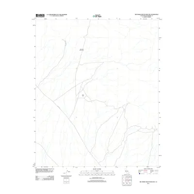
2012 Map of Big Maria Mountains SW
USGS Topo · Published 2012About this map
Big Maria Mountains and the prominent Black Hill define the topography of this Riverside County landscape. The map details a network of desert routes, most notably Arlington Mine Rd and Midland Rd, which suggest a history of resource extraction and transit through the arid terrain. The intricate drainage patterns and dry washes across the sheet reflect the characteristic geomorphology of the Lower Colorado River Valley region. This 2012 survey by the U.S. Geological Survey documents the existing road infrastructure and landforms before more recent changes in land use or environmental shifts impacted the area.
Find a feature on this map
4 named features on this map. Tap any name to fly to it.
Don’t see what you’re looking for? This feature index may not catch every label — zoom into the map to look around manually.
Map Details
Editions of this 2012 Big Maria Mountains SW Map
This is the sole edition of this map. No revisions or reprints were ever made.
Other maps of this area

1942 · Blythe
USGS Topo · 1:250,000

1945 · Big Maria Mtns
USGS Topo · 1:62,500

1945 · Midland
USGS Topo · 1:62,500

1951 · Big Maria Mts
USGS Topo · 1:62,500

1951 · McCoy Wash
USGS Topo · 1:24,000

1951 · Blythe NE
USGS Topo · 1:24,000

1952 · Midland
USGS Topo · 1:62,500

1952 · Mc Coy Spring
USGS Topo · 1:62,500

1954 · Salton Sea
USGS Topo · 1:250,000
1954 · Big Maria Mts. NE
USGS Topo · 1:24,000