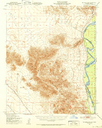
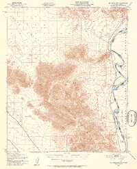
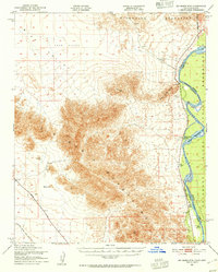
1951 Map of Big Maria Mts
USGS Topo · Published 1952About this map
The Colorado River serves as the dominant boundary in this desert landscape, separating the California and Arizona borderlands. Along its western bank, the Colorado River Indian Reservation Bdy meets small riverside outposts like River Bend Lodge and the Blythe Boat Club. The interior is defined by the striking topography of the Big Maria Mountains and the Riverside Mountains, which rise sharply above the expansive Sand Dunes and Rice Valley.
Find a feature on this map
17 named features on this map. Tap any name to fly to it.
Don’t see what you’re looking for? This feature index may not catch every label — zoom into the map to look around manually.
Map Details
Editions of this 1951 Big Maria Mts Map
3 editions found
Other maps of this area

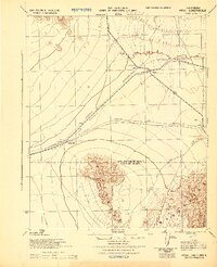
1911 · Parker
USGS Topo · 1:125,000

1931 · Moon Mtn
USGS Topo · 1:62,500

1932 · Moon Mtn
USGS Topo · 1:62,500

1933 · Cunningham Mtn
USGS Topo · 1:48,000

1940 · Dome Rock Mts
USGS Topo · 1:62,500

1942 · Blythe
USGS Topo · 1:250,000

1942 · MOON MTN
USGS Topo · 1:62,500

1943 · Parker
USGS Topo · 1:62,500
1943 · Vidal
USGS Topo · 1:62,500

1945 · Big Maria Mtns
USGS Topo · 1:62,500