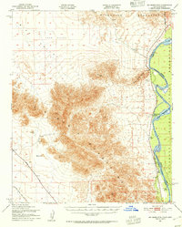
1951 Map of Big Maria Mts
USGS Topo · Published 1955About this map
The Big Maria Mountains dominate this California desert landscape, rising sharply between the expansive Sand Dunes of Rice Valley to the west and the life-giving Colorado River to the east. Along the river’s western bank, small outposts like River Bend Lodge and the Blythe Boat Club suggest a mid-century era of recreational river use, while the Hills Ranch indicates more permanent agricultural or pastoral activity. The Colorado River Indian Reservation occupies much of the eastern bank, marked by the Approximate Arizona-California Boundary that follows the shifting course of the river channel. Transportation is defined by the Atchison Topeka and Santa Fe railroad and Midland Road cutting through the arid flats, where a lone Prospect near Black Hill hints at the region's mining history.
Find a feature on this map
15 named features on this map. Tap any name to fly to it.
Don’t see what you’re looking for? This feature index may not catch every label — zoom into the map to look around manually.
Map Details
Editions of this 1951 Big Maria Mts Map
3 editions found

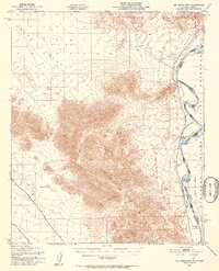
Other maps of this area

1911 · Parker
USGS Topo · 1:125,000

1931 · Moon Mtn
USGS Topo · 1:62,500

1932 · Moon Mtn
USGS Topo · 1:62,500

1933 · Cunningham Mtn
USGS Topo · 1:48,000

1940 · Dome Rock Mts
USGS Topo · 1:62,500

1942 · Blythe
USGS Topo · 1:250,000

1942 · MOON MTN
USGS Topo · 1:62,500

1943 · Parker
USGS Topo · 1:62,500

1943 · Vidal
USGS Topo · 1:62,500

1945 · Big Maria Mtns
USGS Topo · 1:62,500