Old Maps of La Paz County, Arizona
Explore 565 old maps of La Paz County, spanning from 1911 to today. These high-resolution historic maps reveal how streets, neighborhoods, landmarks, and natural features evolved over time — perfect for genealogy, metal detecting, research, and local history exploration.
What you can do with these maps:
- See how La Paz County changed over time: Compare historical maps to modern-day views to trace roads, homesites, rail lines & more.
- View detailed metadata: Each map includes creators, publishers, year, scale, and archive source.
- Overlay maps with satellite & LiDAR: Visualize the past alongside modern tools to explore terrain & human change.
- Trusted historical sources: Maps sourced from the USGS, Library of Congress, and other archives.
- Access maps your way: View online, download high-res files, or order prints for personal or research use.
Start exploring old maps of La Paz County to uncover forgotten places, hidden landmarks, and the deep history beneath your feet.
La Paz County, AZ maps
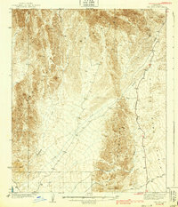
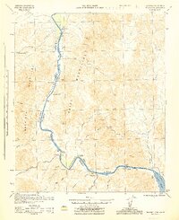
(565)- 1911 Map of Parker
 1911 Parker1911 Print · USGSThe Arizona-California borderlands are captured here in the early twentieth century as the river and rail networks began to transform the desert. Researchers can trace the development of the Colorado River Indian Reservation, the rail hub at Parker, and early mining sites like the Billy Mack Mine.3 unique versions available
 - 1923 Map of Signal
 1923 Signal1923 Print · USGSWestern Arizona in the early twenties was a landscape of isolated mining camps and vital desert springs. Genealogists and historians can trace the footprint of early settlements like Signal and Swansea or locate remote outposts such as Owen and Butler well.
 - 1930 Map of Linskey
 1930 Linskey1930 Print · USGSArizona's western desert frontier comes into focus in this late 1920s survey of the La Posa Plain. Researchers can trace the path of the Atchison Topeka and Santa Fe railroad through Linskey and locate early water sources like Tenmile Well.2 unique versions available
 - 1931 Map of Moon Mtn, 1955 Print
 1931 Moon Mtn1955 Print · USGSThe Arizona-California borderlands are captured here in the early thirties, defined by the winding Colorado River and the stark Dome Rock Mountains. Historians and prospectors can trace mineral workings at the Valenzuella Mine and Mammoth Mine.2 unique versions available
 - 1932 Map of Moon Mtn
 1932 Moon Mtn1932 Print · USGSThe Arizona-California borderlands are captured here in the early 1930s, showing the intersection of tribal lands and desert mining. Genealogists and historians can trace the early boundaries of the Colorado River Indian Reservation and locate industrial sites like the Valenzuela Mine.2 unique versions available
 - 1933 Map of Cunningham Mtn
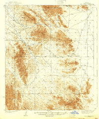
 1933 Cunningham Mtn1933 Print · USGSThe Arizona-California borderlands were a hub of mining and early desert transit during the early 1930s. Researchers can trace the path of the Route No. 60 Sunkist Trail and locate remote operations like the Cinnabar Mine and Beamer Well.4 unique versions available
 - 1934 Map of Trigo Peaks
 1934 Trigo Peaks1934 Print · USGSThe arid reaches of western Arizona appear as they were in the early thirties, during the height of desert surveying. Trace the historical Cibola Road past the Tweed Mine and through the rugged Felipe Pass.
 - 1939 Map of Red Hill
 1939 Red Hill1939 Print · USGSThe high desert of Yuma County is mapped here in the mid-1930s, showing a landscape defined by mining prospects and historic transit routes. You can trace early desert roads and name points like the Annie Mine, Red Hill, and the long Quartzite Yuma Road.3 unique versions available
 - 1939 Map of Trigo Peaks
 1939 Trigo Peaks1939 Print · USGSArizona's high desert reveals its raw geography in the 1930s, showing a landscape defined by mountain corridors and seasonal washes. Researchers can trace early desert transit along the Cibola Road and locate remote industrial sites like the Tweed Mine.2 unique versions available
 - 1940 Map of Dome Rock Mts
 1940 Dome Rock Mts1940 Print · USGSThe Arizona and California borderlands along the Colorado River are captured here during the 1930s mining era. Researchers can trace historic prospecting sites like the Darling Mine and Goodman Mine or locate crossings at Diablo Pass.3 unique versions available
 - 1942 Map of Signal
 1942 Signal1942 Print · USGSNorthwestern Arizona was a rugged network of mining camps and river crossings during the early years of the war. Researchers can trace the isolated roads connecting Signal, the mines at Bagdad, and the remote desert outposts of Swansea and Alamo.
 - 1942 Map of Blythe
 1942 Blythe1942 Print · USGSThe Lower Colorado River valley appears here in the early 1940s, showcasing the agricultural development of the Palo Verde Mesa alongside a booming mining industry. Researchers can locate remote desert outposts and extraction sites like Midland, the U S Gypsum Mine, and Nortons Landing.2 unique versions available
 - 1942 Map of Vicksburg
 1942 Vicksburg1942 Print · USGSWestern Arizona's desert landscape during the early war years is defined here by isolated rail stops and vital water points. Researchers can trace the Atchison Topeka and Santa Fe line through Salome and Vicksburg or locate remote sites like Reids Ranch and the Kofa Mine.
 - 1942 Map of MOON MTN, 1943 Print
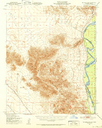
 1942 MOON MTN1943 Print · USGSThe Colorado River valley and its surrounding desert ranges are shown here during the height of the Second World War. Historians can trace the locations of the Parker Alien Reception Center units and former workings at Valenzuella Mines.
 - 1943 Map of Giers Basin
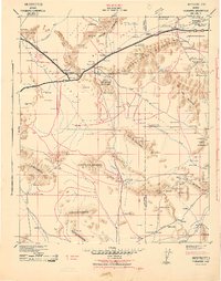
 1943 Giers Basin1943 Print · USGSThe Colorado River borderlands come into focus during the early years of the war, when this area served as a military maneuver zone. Researchers can locate desert water sources like Mohave Spring and Screwbean Spring or trace the early footprint of Parker Dam.
 - 1943 Map of Parker
 1943 Parker1943 Print · USGSThe Lower Colorado riverfront was a vital military and transport corridor during the 1940s. Genealogists and historians can trace the rail and river network connecting Parker to the Colorado River Indian Reservation, Agency, and Doyles Landing.
 - 1945 Map of Big Maria Mtns
 1945 Big Maria Mtns1945 Print · USGSRiverside County and the Arizona border are captured here in the mid-1940s, just as modern desert infrastructure began to solidify. Researchers can trace the path of the Atchison Topeka & Santa Fe and locate sites like Hills Ranch or Quien Sabe Point.
 - 1945 Map of Cibola
 1945 Cibola1945 Print · USGSThe Colorado River borderlands in the mid-1940s reveal a landscape of desert mining and valley agriculture. Researchers can trace the Cibola Road to the Hart Gold Mine or locate early settlements like Cibola and Hodges.
 - 1945 Map of Picacho
 1945 Picacho1945 Print · USGSThe Lower Colorado River corridor is captured here in the mid-1940s, showing a landscape defined by remote mining camps and vital ferry crossings. Trace the history of the regional mineral boom through the Red Cloud Mine, Hoge Ferry, and the Adobe Ruins.
 - 1949 Map of Parker, 1960 Print
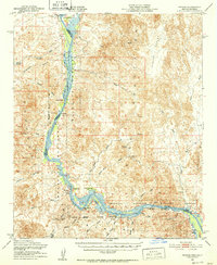
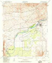 1949 Parker1960 Print · USGSThe Colorado River borderlands in the late 1940s show a fascinating mix of tribal lands, railroad stops, and desert mining. Genealogists and historians can locate the Mojave Indian Ch, the Cremation Ground, and the old Colorado River Day Sch within the reservation.2 unique versions available
 - 1950 Map of Parker Dam Area
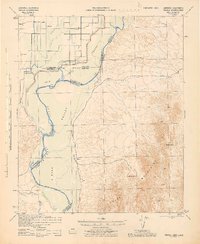
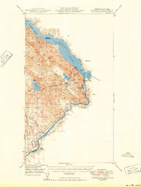 1950 Parker Dam Area1950 Print · USGSThe California-Arizona borderlands come into focus at the mid-century mark, centered on the engineering of the Parker Dam. Trace the river economy through the Colorado River Indian Reservation and remote landmarks like Bandit Pass and Cienega Springs.2 unique versions available
 - 1950 Map of Parker
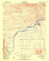 1950 Parker1950 Print · USGSThe Lower Colorado River valley in the mid-century shows a landscape defined by massive water projects and tribal lands. Researchers can trace the Colorado River Indian Reservation boundary, the Headgate Rock Dam, and desert mining at the Blue Cloud Mine.2 unique versions available
 - 1950 Map of Prescott, 1951 Print
 1950 Prescott1951 Print · USGSArizona's mining and ranching frontiers were in full operation during the early fifties, from the vertical streets of Jerome to the remote western desert. Genealogists and researchers can trace rural life via the Bland School, the United Verde Mine, and stops along the Atchison Topeka and Santa Fe Railway.
 - 1951 Map of Big Maria Mts, 1952 Print
 1951 Big Maria Mts1952 Print · USGSThe Colorado River desert frontier in the early fifties reveals a landscape of high peaks and isolated riverside outposts. Researchers can trace the Atchison Topeka and Santa Fe railroad line and locate riverside sites like River Bend Lodge and Hills Ranch.3 unique versions available
 - 1951 Map of Picacho, 1952 Print
 1951 Picacho1952 Print · USGSThe Colorado River corridor along the Arizona-California border is shown here in the early fifties, balancing wildlife conservation with a legacy of desert mining. Researchers can trace historic river landings and mountain operations like Nortons Landing (Site), Picacho, and the Red Cloud Mine.3 unique versions available
Showing maps 1-25 of 565
Top cities of La Paz County
- Quartzsite historical maps
- Parker historical maps
- Salome historical maps
- Ehrenberg historical maps
- Bouse historical maps
- Bluewater historical maps
See more
Frequently asked questions
- What are the different types of historical maps available for La Paz County?
- What is the oldest map of La Paz County?
- Where can I purchase historical maps of La Paz County for my home or office?
- Where can I download high-res historical maps of La Paz County?
- Are there historical topographic maps available for La Paz County?
- Is there historical aerial imagery available for La Paz County?
- Where are historical maps of La Paz County sourced from?