
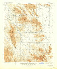
1939 Map of Trigo Peaks
USGS Topo · Published 1939About this map
North Trigo Peaks and South Trigo Peaks dominate this arid landscape, surveyed in the mid-1930s before modern development reshaped the Southwest. The terrain is defined by complex drainage networks like Trigo Wash, Mohave Wash, and Gould Wash which cut through the Dome Rock Mountains and the Chocolate Mountains. A primary surveying landmark, the Gila and Salt River Base Line, bisects the map, providing a critical reference point for territorial land division in the region.
Find a feature on this map
19 named features on this map. Tap any name to fly to it.
Don’t see what you’re looking for? This feature index may not catch every label — zoom into the map to look around manually.
Map Details
Editions of this 1939 Trigo Peaks Map
2 editions found
Other maps of this area

1933 · Cunningham Mtn
USGS Topo · 1:48,000

1934 · Trigo Peaks
USGS Topo · 1:48,000

1939 · Red Hill
USGS Topo · 1:62,500

1940 · Dome Rock Mts
USGS Topo · 1:62,500

1942 · Blythe
USGS Topo · 1:250,000

1945 · Cibola
USGS Topo · 1:62,500

1945 · Picacho
USGS Topo · 1:62,500

1951 · Picacho
USGS Topo · 1:62,500

1951 · Blythe
USGS Topo · 1:24,000

1951 · Cibola
USGS Topo · 1:62,500