1930s Maps of La Paz County, Arizona
Explore 7 historic maps of La Paz County from the 1930s. These maps offer a rare glimpse into what life looked like during the 1930s — showing old roads, neighborhoods, homes, and landmarks that have changed or disappeared over time.
Whether you're researching your family's past, planning a metal detecting trip, or studying how La Paz County's landscape evolved across the 1930s, these high-resolution maps are a powerful tool for exploring the history of this region.
- Focus on a specific era: All maps on this page are from the 1930s, giving you a focused view of this time period.
- See what’s changed: Compare century-old streets, trails, and buildings to today's modern landscape using overlays and satellite layers.
- Research with precision: Use these maps for genealogy, historical research, land use analysis, or educational projects.
- View, download, or print: Maps are fully viewable online in high resolution, and can be downloaded or printed for your own records.
Start exploring La Paz County's history through authentic maps from the 1930s. This is your window into the past.
La Paz County, AZ maps
(7)- 1930 Map of Linskey
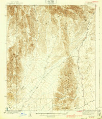
 1930 Linskey1930 Print · USGSArizona's western desert frontier comes into focus in this late 1920s survey of the La Posa Plain. Researchers can trace the path of the Atchison Topeka and Santa Fe railroad through Linskey and locate early water sources like Tenmile Well.2 unique versions available
 - 1931 Map of Moon Mtn, 1955 Print
 1931 Moon Mtn1955 Print · USGSThe Arizona-California borderlands are captured here in the early thirties, defined by the winding Colorado River and the stark Dome Rock Mountains. Historians and prospectors can trace mineral workings at the Valenzuella Mine and Mammoth Mine.2 unique versions available
 - 1932 Map of Moon Mtn
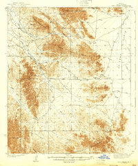
 1932 Moon Mtn1932 Print · USGSThe Arizona-California borderlands are captured here in the early 1930s, showing the intersection of tribal lands and desert mining. Genealogists and historians can trace the early boundaries of the Colorado River Indian Reservation and locate industrial sites like the Valenzuela Mine.2 unique versions available
 - 1933 Map of Cunningham Mtn
 1933 Cunningham Mtn1933 Print · USGSThe Arizona-California borderlands were a hub of mining and early desert transit during the early 1930s. Researchers can trace the path of the Route No. 60 Sunkist Trail and locate remote operations like the Cinnabar Mine and Beamer Well.4 unique versions available
 - 1934 Map of Trigo Peaks
 1934 Trigo Peaks1934 Print · USGSThe arid reaches of western Arizona appear as they were in the early thirties, during the height of desert surveying. Trace the historical Cibola Road past the Tweed Mine and through the rugged Felipe Pass.
 - 1939 Map of Red Hill
 1939 Red Hill1939 Print · USGSThe high desert of Yuma County is mapped here in the mid-1930s, showing a landscape defined by mining prospects and historic transit routes. You can trace early desert roads and name points like the Annie Mine, Red Hill, and the long Quartzite Yuma Road.3 unique versions available
 - 1939 Map of Trigo Peaks
 1939 Trigo Peaks1939 Print · USGSArizona's high desert reveals its raw geography in the 1930s, showing a landscape defined by mountain corridors and seasonal washes. Researchers can trace early desert transit along the Cibola Road and locate remote industrial sites like the Tweed Mine.2 unique versions available
End of results
Showing maps 1-7 of 7
Top cities of La Paz County
- Quartzsite historical maps
- Parker historical maps
- Salome historical maps
- Ehrenberg historical maps
- Bouse historical maps
- Bluewater historical maps
See more
Frequently asked questions
- What are the different types of historical maps available for La Paz County?
- What is the oldest map of La Paz County?
- Where can I purchase historical maps of La Paz County for my home or office?
- Where can I download high-res historical maps of La Paz County?
- Are there historical topographic maps available for La Paz County?
- Is there historical aerial imagery available for La Paz County?
- Where are historical maps of La Paz County sourced from?