1960s Maps of La Paz County, Arizona
Explore 36 historic maps of La Paz County from the 1960s. These maps offer a rare glimpse into what life looked like during the 1960s — showing old roads, neighborhoods, homes, and landmarks that have changed or disappeared over time.
Whether you're researching your family's past, planning a metal detecting trip, or studying how La Paz County's landscape evolved across the 1960s, these high-resolution maps are a powerful tool for exploring the history of this region.
- Focus on a specific era: All maps on this page are from the 1960s, giving you a focused view of this time period.
- See what’s changed: Compare century-old streets, trails, and buildings to today's modern landscape using overlays and satellite layers.
- Research with precision: Use these maps for genealogy, historical research, land use analysis, or educational projects.
- View, download, or print: Maps are fully viewable online in high resolution, and can be downloaded or printed for your own records.
Start exploring La Paz County's history through authentic maps from the 1960s. This is your window into the past.
La Paz County, AZ maps
(36)- 1960 Map of Prescott
 1960 Prescott1960 Print · USGSYavapai County and the surrounding high-desert mining districts are captured here during a period of steady industrial and rail activity. Researchers can trace the routes of the Atchison Topeka and Santa Fe Railway and locate historic sites like the United Verde Mine and Bland School.2 unique versions available
 - 1960 Map of Phoenix
 1960 Phoenix1960 Print · USGSCentral Arizona in the mid-fifties reveals a landscape of rapid suburban growth alongside enduring desert mining and ranching. Genealogists and historians can trace rail-side settlements like Vicksburg Junction and Waddell, or locate the Vulture Mine and early sites like Agua Fria School.
 - 1961 Map of Salome, 1962 Print
 1961 Salome1962 Print · USGSThe McMullen Valley comes to life in the early sixties, centered on the railroad towns of Salome and Wenden. Genealogists and historians can trace local landmarks like the Salome High Sch, the town Cemetery, and numerous mining claims such as the Bonanza Mine.3 unique versions available
 - 1961 Map of Hope, 1963 Print
 1961 Hope1963 Print · USGSThe Harquahala Mountains area in the early 1960s reveals a classic Arizona landscape of mining, rail, and high-desert outposts. Researchers can trace the Atchison Topeka and Santa Fe rail line through Hope or locate the historic Golden Eagle Mine and Coyote Well.2 unique versions available
 - 1961 Map of Lone Mountain, 1963 Print
 1961 Lone Mountain1963 Print · USGSThe Harquahala Valley in the early sixties was a rugged frontier of hard-rock mining and isolated desert wells. Researchers can trace the footprint of the mining era at the Socorro Mine and Alaska Mine, or locate early ranching landmarks like Government Well.2 unique versions available
 - 1961 Map of Gladden, 1963 Print
 1961 Gladden1963 Print · USGSThe Arizona desert of the early 1960s is defined here by the rise of the Harquahala Mountains and the busy Atchison Topeka and Santa Fe rail line. Researchers can locate remote mining sites like the White Marble Mine and Hidden Treasure Mine or trace the early settlement at Gladden.3 unique versions available
 - 1962 Map of Little Horn Mts, 1963 Print
 1962 Little Horn Mts1963 Print · USGSThe high desert of western Arizona comes into focus in the early sixties as a site for military testing and wildlife preservation. Trace remote desert travel along Hovatter Road and locate the Oakland Mine and Soldiers Tank.2 unique versions available
 - 1962 Map of Utting, 1963 Print
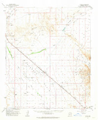 1962 Utting1963 Print · USGSArizona's western desert comes into focus during the early sixties, centered on the vital rail link through the Ran Egras Plain. Genealogists and historians can trace isolated desert outposts like Utting, McVay, and mining operations such as the Barber Gene Mine.2 unique versions available
 - 1962 Map of Quartzsite, 1964 Print
 1962 Quartzsite1964 Print · USGSThe Arizona desert in the early sixties is captured here as a landscape of mining prospects and historic landmarks. Trace the early settlement at Quartzsite, find the Hi Jolly Monument, or locate remote sites like the Gold Nugget Mine and Old Fort Tyson.2 unique versions available
 - 1962 Map of Bouse, 1964 Print
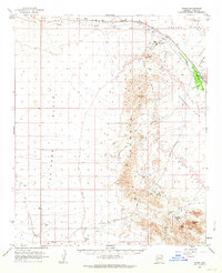 1962 Bouse1964 Print · USGSCovers La Paz County, including Parker, Bouse, and other nearby areas2 unique versions available
 - 1962 Map of Kofa Butte, 1964 Print
 1962 Kofa Butte1964 Print · USGSYuma County mining and desert survival are documented here during the early sixties within the Kofa Mountains. Researchers can trace the layout of the King of Arizona Mine, locate Petroglyphs, and identify remote sites like Wilbanks Cabin.3 unique versions available
 - 1962 Map of Eagletail Mts, 1964 Print
 1962 Eagletail Mts1964 Print · USGSThe desert landscape of Yuma and Maricopa counties is mapped here in the early 1960s during a period of active mining and ranching. Researchers can locate remote sites like the Double Eagle Mine, Clanton Well, and the prominent spire of Courthouse Rock.3 unique versions available
 - 1962 Map of Livingston Hills, 1964 Print
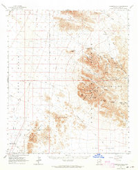 1962 Livingston Hills1964 Print · USGSYuma County’s desert interior is documented here during the early sixties, showing the vital network of springs and mines that defined this arid landscape. Researchers can locate remote outposts like Stone Cabin and trace routes through Stagecoach Pass or past the Amuy Mine.3 unique versions available
 - 1962 Map of Vicksburg, 1964 Print
 1962 Vicksburg1964 Print · USGSCovers La Paz County, including Brenda, Vicksburg, and other nearby areas2 unique versions available
 - 1963 Map of Salton Sea
 1963 Salton Sea1963 Print · USGSThe Colorado Desert during the early sixties shows a landscape defined by massive water projects and Cold War military ranges. Trace the growth of Salton City and Brawley, or locate remote desert outposts like the Paymaster Mine and Desert Center.
 - 1964 Map of Picacho, 1966 Print
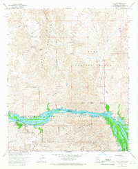 1964 Picacho1966 Print · USGSThe Colorado River border and Trigo Mountains are mapped here in the mid-1960s, showing a landscape defined by mining and wildlife conservation. Researchers can locate remote desert workings like the Black Rock Mine or the historical Picacho Mill (Ruins).3 unique versions available
 - 1964 Map of Mule Wash, 1966 Print
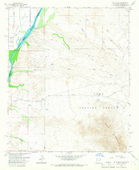 1964 Mule Wash1966 Print · USGSThis borderland survey from the mid-sixties tracks the Colorado River as it winds between Riverside and Yuma counties. Map collectors and historians can trace the early irrigation canals of the Palo Verde Valley and the vast, unpaved expanses of the Yuma Proving Ground via the Cibola Road.2 unique versions available
 - 1965 Map of Salton Sea
 1965 Salton Sea1965 Print · USGSThe Colorado Desert and Imperial Valley are caught in a period of intense irrigation and military expansion during the mid-sixties. Researchers can trace the desert's industrial footprint through the Eagle Mountain Mine, the remote Desert Center, and the Salton Sea Test Base.
 - 1965 Map of Prescott
 1965 Prescott1965 Print · USGSArizona's mining heartland is captured during the mid-sixties, from the copper mines of Jerome to the cattle country of Williamson Valley Wash. Genealogists and historians can trace old mining camps at Octave and Stanton or the historic Whipple Military Reservation.
 - 1965 Map of Picacho NW, 1966 Print
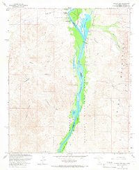 1965 Picacho NW1966 Print · USGSThe Colorado River corridor near the California-Arizona border comes to life in this mid-1960s survey. Researchers can trace the river's original wetlands and backwaters, locating specific historical sites like Paymaster Landing, Walters Camp, and the Clip Mill (Site).2 unique versions available
 - 1965 Map of Cibola, 1966 Print
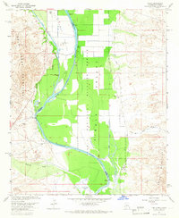 1965 Cibola1966 Print · USGSThe Arizona-California border comes alive in the mid-1960s as the river shapes the valley's development and conservation. Genealogists and historians can trace the settlement of Cibola, the local Cem, and desert landmarks like the Landing Strip and Davis Lake.3 unique versions available
 - 1965 Map of Hidden Valley, 1966 Print
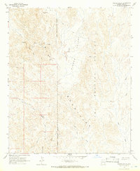 1965 Hidden Valley1966 Print · USGSThe Trigo Mountains are captured here in the mid-1960s, showing a desert landscape split between military use and old mining claims. Researchers can trace remote jeep trails to the Black Diamond Mine and Clip Mine within the Yuma Proving Ground.2 unique versions available
 - 1965 Map of Palo Verde, 1966 Print
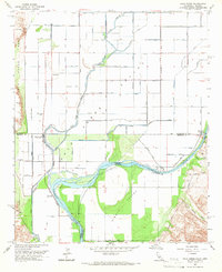 1965 Palo Verde1966 Print · USGSThe Colorado River borderlands in the mid-sixties reveal a landscape defined by industrial irrigation and desert crossings. You can trace the historic Bradshaw Trail, locate the Cibola Bridge, and explore the waterways of the Cibola National Wildlife Refuge.4 unique versions available
 - 1965 Map of Cibola SE, 1966 Print
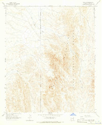 1965 Cibola SE1966 Print · USGSIn the mid-1960s, this desert reach of Arizona was a land of military ranges and isolated mineral claims. Trace the historical route to the Hart Mine or navigate the arid terrain of Crazy Woman Wash and the peaks of the Trigo Mountains.3 unique versions available
 - 1965 Map of Picacho SW, 1966 Print
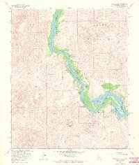 1965 Picacho SW1966 Print · USGSThe Colorado River borderlands in the mid-sixties reveal a landscape of desert washes and riverfront ranch sites. Researchers can trace historical riverside locations like Nortons Landing (Site), Hoge Ranch (Site), and the remote Carrizo Spring.3 unique versions available
Showing maps 1-25 of 36
Top cities of La Paz County
- Quartzsite historical maps
- Parker historical maps
- Salome historical maps
- Ehrenberg historical maps
- Bouse historical maps
- Bluewater historical maps
See more
Frequently asked questions
- What are the different types of historical maps available for La Paz County?
- What is the oldest map of La Paz County?
- Where can I purchase historical maps of La Paz County for my home or office?
- Where can I download high-res historical maps of La Paz County?
- Are there historical topographic maps available for La Paz County?
- Is there historical aerial imagery available for La Paz County?
- Where are historical maps of La Paz County sourced from?