
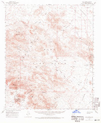
1962 Map of Kofa Butte
USGS Topo · Published 1964About this map
The Kofa Mountains and Ran Egras Plain define this desert landscape, which in the early 1960s was dominated by mining operations and the remote Kofa Game Refuge. Evidence of early human presence is marked by Petroglyphs near Alamo Spring, while the industrial history is anchored by the King of Arizona Mine and the North Star Mine near Kofa Butte. These mines, once centers of regional extraction, are accompanied by a Cemetery and various support structures like Wilbanks Cabin.
Find a feature on this map
62 named features on this map. Tap any name to fly to it.
Don’t see what you’re looking for? This feature index may not catch every label — zoom into the map to look around manually.
Map Details
Editions of this 1962 Kofa Butte Map
3 editions found
Other maps of this area

1942 · Blythe
USGS Topo · 1:250,000

1942 · Vicksburg
USGS Topo · 1:250,000

1954 · Salton Sea
USGS Topo · 1:250,000

1954 · Phoenix
USGS Topo · 1:250,000

1955 · Salton Sea
USGS Topo · 1:250,000

1957 · Phoenix
USGS Topo · 1:250,000

1958 · Phoenix
USGS Topo · 1:250,000

1959 · Salton Sea
USGS Topo · 1:250,000

1960 · Phoenix
USGS Topo · 1:250,000

1961 · Hope
USGS Topo · 1:62,500