
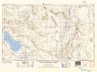
1955 Map of Salton Sea
USGS Topo · Published 1955About this map
The Salton Sea and its surrounding desert basins dominate this mid-century landscape, revealing a complex network of agricultural irrigation and industrial extraction. In the southeast, the intensely farmed Imperial Valley is visible via the West Side Main Canal and Coachella Canal, while the Colorado River marks the eastern boundary. The map captures a difficult period of modern history, documenting the locations of the Parker Alien Reception Center Unit No 1 and its sister units on the Colorado River Indian Reservation.
Find a feature on this map
159 named features on this map. Tap any name to fly to it.
Don’t see what you’re looking for? This feature index may not catch every label — zoom into the map to look around manually.
Map Details
Editions of this 1955 Salton Sea Map
2 editions found
Other maps of this area

1903 · Yuma
USGS Topo · 1:125,000

1904 · Indio
USGS Topo · 1:125,000

1905 · Yuma
USGS Topo · 1:125,000

1907 · Holtville
USGS Topo · 1:125,000

1911 · Parker
USGS Topo · 1:125,000

1915 · El Centro
USGS Topo · 1:125,000

1923 · Signal
USGS Topo · 1:250,000

1928 · Norton
USGS Topo · 1:62,500

1929 · Laguna
USGS Topo · 1:62,500

1929 · Norton
USGS Topo · 1:62,500