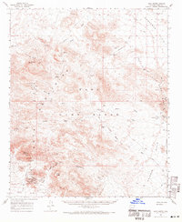
1962 Map of Kofa Butte
USGS Topo · Published 1971About this map
The Kofa Range dominates this desert landscape in the early 1960s, serving as a backdrop for a storied mining history within the Kofa Game Refuge Boundary. Significant operations like the King of Arizona Mine and the North Star Mine are detailed alongside their supporting infrastructure, including the North Star Well 14 and a small Cemetery nearby. The presence of Petroglyphs near Alamo Spring indicates an ancient human connection to these arid peaks long before the arrival of twentieth-century prospectors.
Find a feature on this map
50 named features on this map. Tap any name to fly to it.
Don’t see what you’re looking for? This feature index may not catch every label — zoom into the map to look around manually.
Map Details
Editions of this 1962 Kofa Butte Map
3 editions found

Other maps of this area

1942 · Blythe
USGS Topo · 1:250,000

1942 · Vicksburg
USGS Topo · 1:250,000

1954 · Salton Sea
USGS Topo · 1:250,000

1954 · Phoenix
USGS Topo · 1:250,000

1955 · Salton Sea
USGS Topo · 1:250,000

1957 · Phoenix
USGS Topo · 1:250,000

1958 · Phoenix
USGS Topo · 1:250,000

1959 · Salton Sea
USGS Topo · 1:250,000

1960 · Phoenix
USGS Topo · 1:250,000

1961 · Hope
USGS Topo · 1:62,500