
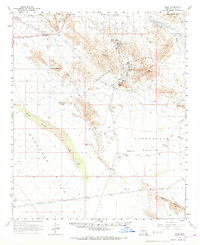
1961 Map of Hope
USGS Topo · Published 1963About this map
Harquahala Mountains dominate this western Arizona landscape, where high-desert mining and aviation infrastructure define the early 1960s character of the region. The small settlement of Hope sits along the Atchison Topeka and Santa Fe railroad, serving as a hub for the surrounding ranching and prospecting lands. Evidence of mineral exploration is visible in the foothills, specifically at the Golden Eagle Mine and Harquahala Mine, while the southern expanse of the Harquahala Plains reveals the Salome Emergency Airfield and more remote landmarks like Sore Fingers. Historical land use is further recorded through the presence of a Cem and isolated outposts like Forbes Ranch. The southern portion of the survey transitions into the protected desert of the Kofa Game Refuge and the rugged Eagle Tail Mountains, providing a detailed view of the natural drainage systems including Bouse Wash and Harrisburg Wash.
Find a feature on this map
26 named features on this map. Tap any name to fly to it.
Don’t see what you’re looking for? This feature index may not catch every label — zoom into the map to look around manually.
Map Details
Editions of this 1961 Hope Map
2 editions found
Other maps of this area

1942 · Vicksburg
USGS Topo · 1:250,000

1954 · Phoenix
USGS Topo · 1:250,000

1957 · Phoenix
USGS Topo · 1:250,000

1958 · Phoenix
USGS Topo · 1:250,000

1960 · Phoenix
USGS Topo · 1:250,000

1961 · Salome
USGS Topo · 1:62,500

1961 · Lone Mountain
USGS Topo · 1:62,500

1961 · Gladden
USGS Topo · 1:62,500

1962 · Little Horn Mts
USGS Topo · 1:62,500
1962 · Utting
USGS Topo · 1:62,500