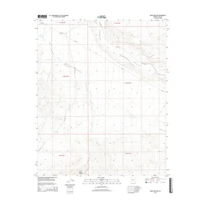
2014 Map of Smith Peak NW
USGS Topo · Published 2014About this map
The Little Buckskin Mountains rise in the southern reaches of this arid landscape, defining a region where dry drainage systems shape the desert floor. Primary watercourses like Bullard Wash and Date Creek cut across the terrain, indicating the historical pathways of seasonal runoff in this part of La Paz County. The area is intersected by a network of primitive and improved routes, including Alamo Rd and Palmerita Rd, which reflect the remote transportation patterns of the early 21st century. These roads serve as vital connectors in an otherwise sparsely populated environment, following the natural contours and breaks between the mountain foothills and the wash basins. The presence of New Alamo Rd and Date Creek Rd further illustrates the localized access points developed for ranching or land management in the Arizona desert.
Find a feature on this map
14 named features on this map. Tap any name to fly to it.
Don’t see what you’re looking for? This feature index may not catch every label — zoom into the map to look around manually.
Map Details
Editions of this 2014 Smith Peak NW Map
This is the sole edition of this map. No revisions or reprints were ever made.
Other maps of this area

1923 · Signal
USGS Topo · 1:250,000

1942 · Signal
USGS Topo · 1:250,000

1950 · Prescott
USGS Topo · 1:250,000

1954 · Prescott
USGS Topo · 1:250,000

1958 · Prescott
USGS Topo · 1:250,000

1959 · Prescott
USGS Topo · 1:250,000

1960 · Prescott
USGS Topo · 1:250,000

1965 · Prescott
USGS Topo · 1:250,000

1966 · Ives Peak
USGS Topo · 1:62,500

1966 · Artillery Peak
USGS Topo · 1:62,500