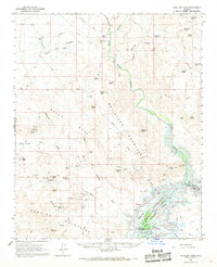
1966 Map of Artillery Peak
USGS Topo · Published 1968About this map
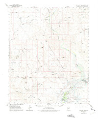
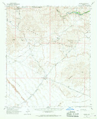
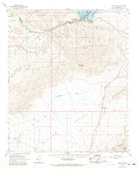
Mining claims and desert springs define this mid-century view of the Arizona interior, where the Big Sandy River and Santa Maria River converge to form the Bill Williams River. The landscape is transitioning during this 1960s survey as the Alamo Reservoir project begins to take shape, with blue hatching indicating future inundation zones near Alamo Crossing. The map preserves the location of the former mining town at Signal (Site) and a dense concentration of mineral works across the Rawhide Mountains and Artillery Mountains. Researchers will find numerous named shafts including the Cactus Queen Mine, Bonanza Mine, and the Black Diamond Mine. These remote sites are linked by a network of jeep trails and Signal Road, reflecting the rugged industrial activity that persisted long after the initial frontier boom.
Find a feature on this map
77 named features on this map. Tap any name to fly to it.
Don’t see what you’re looking for? This feature index may not catch every label — zoom into the map to look around manually.
Map Details
Editions of this 1966 Artillery Peak Map
2 editions found
Other maps of this area

1923 · Signal
USGS Topo · 1:250,000

1942 · Signal
USGS Topo · 1:250,000

1950 · Prescott
USGS Topo · 1:250,000

1954 · Prescott
USGS Topo · 1:250,000

1958 · Prescott
USGS Topo · 1:250,000

1959 · Prescott
USGS Topo · 1:250,000

1960 · Prescott
USGS Topo · 1:250,000

1965 · Prescott
USGS Topo · 1:250,000
1966 · Swansea
USGS Topo · 1:62,500
1966 · Ives Peak
USGS Topo · 1:62,500