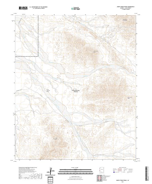
2021 Map of North Trigo Peaks
USGS Topo · Published 2021About this map
The Great Colorado Valley defines the central topography of this desert landscape, framed by the jagged silhouettes of the Trigo Mountains and the Dome Rock Mountains to the north. This modern survey illustrates the complex drainage network characteristic of the Arizona desert, where numerous ephemeral watercourses like Trigo Wash, Weaver Wash, and Mohave Wash carve deep into the basin floor. These washes serve as the primary geological features connecting the higher elevations of the North Trigo Peaks and South Trigo Peaks to the valley below.
Find a feature on this map
18 named features on this map. Tap any name to fly to it.
Don’t see what you’re looking for? This feature index may not catch every label — zoom into the map to look around manually.
Map Details
Editions of this 2021 North Trigo Peaks Map
This is the sole edition of this map. No revisions or reprints were ever made.
Other maps of this area

1933 · Cunningham Mtn
USGS Topo · 1:48,000

1934 · Trigo Peaks
USGS Topo · 1:48,000

1939 · Trigo Peaks
USGS Topo · 1:62,500

1940 · Dome Rock Mts
USGS Topo · 1:62,500

1942 · Blythe
USGS Topo · 1:250,000

1945 · Cibola
USGS Topo · 1:62,500

1951 · Blythe
USGS Topo · 1:24,000

1951 · Cibola
USGS Topo · 1:62,500

1952 · Mule Wash
USGS Topo · 1:24,000

1954 · Salton Sea
USGS Topo · 1:250,000