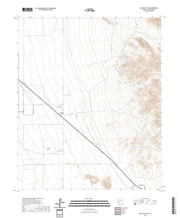
2021 Map of East of Utting
USGS Topo · Published 2021About this map
Ranegras Plain dominates this arid landscape in La Paz County, where the stark divide between flat desert floor and the rising slopes of the Granite Wash Mountains is clearly defined. The modern industrial presence is marked by the Central Arizona Project Aqueduct, which cuts a linear path across the terrain to transport water through the desert. Near the small settlement of McVay, a network of rural routes like N Mc Vay Rd and Plog Way provides access to the surrounding ranching and mining land. To the southeast, the Bush Pit signifies local mineral or aggregate extraction, while seasonal drainage patterns are recorded in the paths of Big Granite Wash and Bouse Wash. This survey reflects the intersection of traditional land use and large-scale water infrastructure in the Arizona backcountry.
Find a feature on this map
23 named features on this map. Tap any name to fly to it.
Don’t see what you’re looking for? This feature index may not catch every label — zoom into the map to look around manually.
Map Details
Editions of this 2021 East of Utting Map
This is the sole edition of this map. No revisions or reprints were ever made.
Other maps of this area

1942 · Vicksburg
USGS Topo · 1:250,000

1954 · Phoenix
USGS Topo · 1:250,000

1957 · Phoenix
USGS Topo · 1:250,000

1958 · Phoenix
USGS Topo · 1:250,000

1960 · Phoenix
USGS Topo · 1:250,000

1961 · Salome
USGS Topo · 1:62,500

1961 · Hope
USGS Topo · 1:62,500
1962 · Utting
USGS Topo · 1:62,500

1962 · Vicksburg
USGS Topo · 1:62,500

1969 · Phoenix
USGS Topo · 1:250,000